Backpacking in the Selway-Bitterroot Wilderness, Idaho
The Selway-Bitterroot Wilderness is a 1.3 million acre Federally-designated Wilderness area located in the Idaho panhandle, straddling the border with Montana (much of which follows the Continental Divide). The portion I visited (on the far northern boundary) is much different than the Lemhi Range, where I had gone the month before. These mountains are significantly greener, with thicker and lusher vegetation and more humidity. They are also very steep and rugged, making off-trail hiking a significant challenge. The trails themselves are generally not as steep, with mostly gradual and well-graded ascents and descents rather than really steep climbs.
My plan was to drive from Coeur d'Alene on the first day (about a five hour drive), and hike in a few miles to camp that same night. The route I planned to follow was another one from the book "Backpacking Idaho" by Douglas Lorain. In the past I have rarely used guidebooks like this, but it has been very helpful in choosing places to go in my new state, which has an astonishing amount of wilderness (I recently read that 60% of the state is Federal land, including National Forest and BLM land). I have, however, learned to disregard the author's estimates of how long it will take to hike the different sections, and to plan based on my own capabilities instead.
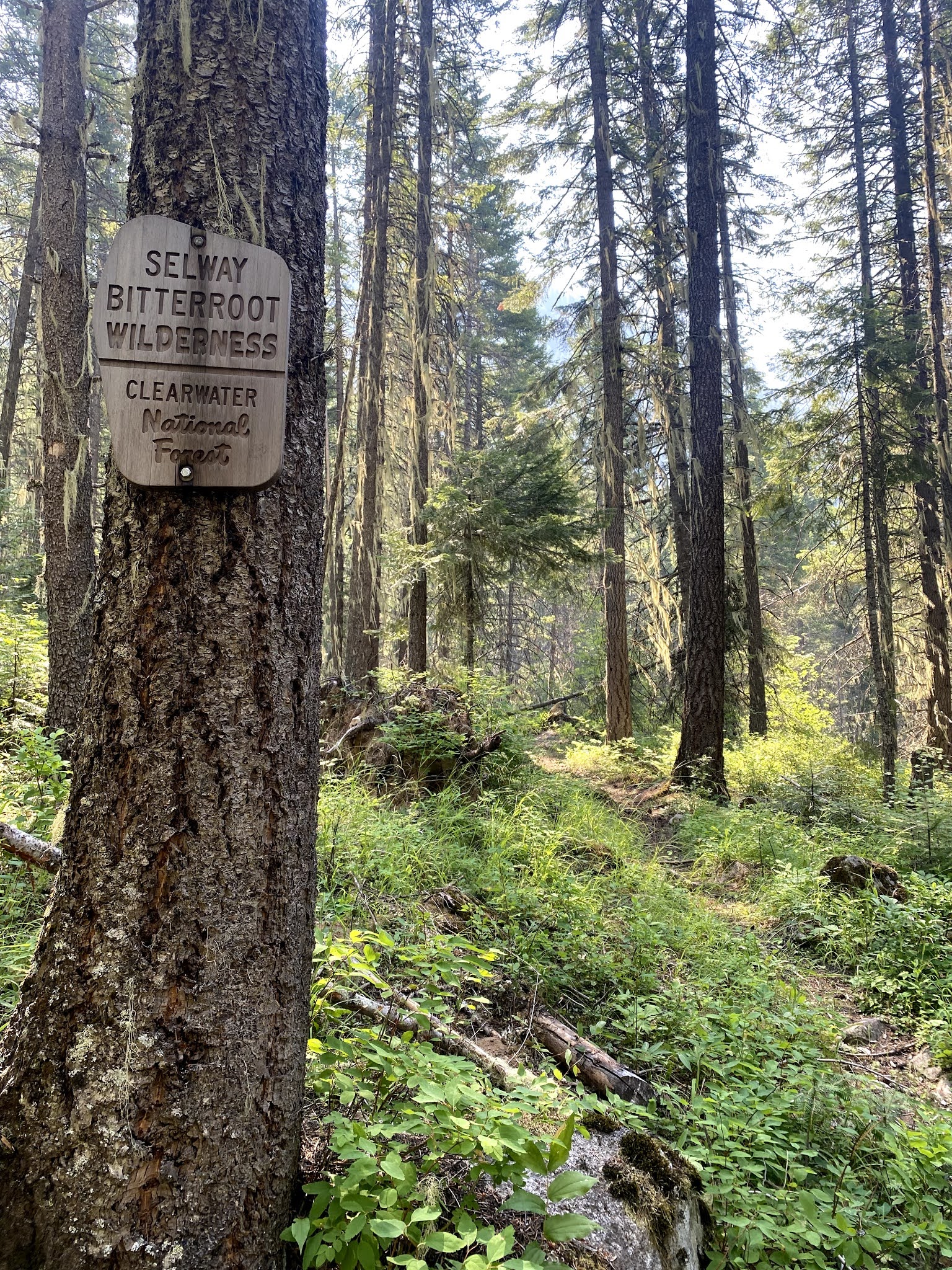
This particular hike started at the Warm Springs trailhead, on US Highway 12 along the Lochsa River. My drive to the trailhead took me south on US 95 to Lewiston, ID, and then east on US 12 to the trailhead. The western end of US 12 went through the Nez Perce Indian Reservation, an area of steep rolling hills with relatively few forested areas. As I proceeded eastwards the proportion of forested land increased. As I left Kooskia and headed off the reservation and into the Clearwater National Forest, I saw a sign that made me smile, so I turned around and went back to take a photo of it.
 |
| This sign made me smile. |
 |
| My map calls it the Nez Perce-Clearwater National Forest. |
 |
| It's easy to see why they call this the "Clearwater River". |
 |
| I didn't know in advance, but this road is one of Idaho's Scenic Byways, and is part of the Lewis and Clark Trail. Next time I will drive it without a time limit so I can stop and read the historical markers. |
 |
| The Warm Springs Trailhead, starting point for a very popular day hike and also my starting point. |
I finally reached the trailhead at 1530, about 350 miles and five and a half hours after my departure. I had read that the hike to the Jerry Johnson Hot Springs is one of the most popular hikes in the Clearwater National Forest. The area is managed for day use only, so I had to get past the hot springs area before I could camp for the night. I met seven people on my way in, all coming back from day hikes to the hot springs. These would be the last people I would see for the next eight days.
With that introduction, here is a map of my trip using Garmin Connect (I still haven't figured out a way to link photos to the track to show their locations, nor to get the map to display the waypoints I made for campsites and other significant locations):
Garmin Connect Map of the Trip (Note: apparently these cannot be viewed by other people. Leaving it here as a placeholder for when I figure out how to create and post a publicly-viewable map of my trip).
And here is a day by day summary of the trip:
I got to the trailhead at 1530, and started hiking at 1625. The first couple of miles were very easy, as the trail is a popular day-hike so it was wide and well-trodden. The hot springs were interesting, but not especially compelling to me. As it was late in the day, I did not stop, but told myself I'd stop for a soak on my way out (by which time I'd probably really need it!).
 |
| A section of the trail to the hot springs. |
 |
| Further down the trail. I didn't see it at the time, but that side trail leads down to a warm pool right by the main creek. |
 |
| The largest pool that I saw on my way past. Everyone had left for the day by the time I got there. |
Once I got out of the day use area, the trail gradually became narrower and less well-trodden. I stopped to ford Cooperation Creek. There was only one deep part higher than my boots, and my long-pants/gaiters system worked well again. I reached a reasonably flat area off to the side of the trail at about 1930. The trail started to climb after this point, so I decided that was where I'd make camp. There were no flying insects to speak of, so I didn't bother with the tent and slept in the open.
 |
| My first night's campsite, next to Warm Springs Creek |
Getting water from Warm Springs Creek was a preview of what was to come - it is a beautiful stream, full of large rocks, whitewater, and deep pools and eddies. If you were willing to pick your way along it I am sure that a lot of it goes un-fished and would provide plenty of supplemental nutrition. As it was, I was too tired, and just took some photos to try to capture its beauty.
 |
| Warm Springs Creek, looking north (upstream) |
This trip I had determined to try freeze-dried dinners instead of my previous fare. I boiled some water and had a Mountain House Pro-Pak Beef Stroganoff dinner. It was delicious and satisfying. That and a large mug of Twining's Jasmine Green Tea sent me into a sound night's sleep. It was such a warm night that I barely used the sleeping bag - it was more of a blanket that I tossed on and off as needed.
 |
| I invested in titanium cookware as an upgrade from my 1970s-era aluminum pots. It was worth it. |
 |
| The view from my bedroom as the sun went down. The stars were crystal clear, and at some point in the night I woke up and identified the constellations Hercules and Draco overhead. |
The first night was kind of a short one - I didn't get to bed for good until 2300, and woke around 0345 as it was already getting light. I dozed on and off for awhile, until I finally sat up and started making breakfast at 0530. My decision to ditch the Klymit air mattress and go back to my classic standard Thermarest pad and its accessory chair proved to be a very good one. The pad did not migrate through the night at all and I slept very comfortably. The chair proved invaluable time and again through the trip, so its place on my list of gear is secure. I was almost packed up to go when the sun peeked through the trees over the mountain, and I started hiking at 0920.
 |
| The sun peeks out just as I am almost packed and ready to set off for the day. |
The trail was distinct and not difficult, and I enjoyed a steady but relatively gentle ascent. For much of the time I could hear Warm Springs Creek off to the right and downhill, but only caught occasional glimpses of it from time to time. Eventually I came to the actual Wilderness boundary. Like most of the USFS designated Wilderness areas I have visited, this one is surrounded by a buffer zone of multiple-use National Forest. Although there was no discernible difference as I crossed into the Wilderness, I knew that from this point on there would be no motors or vehicles of any kind to disturb the quiet peacefulness of the forest.
 |
| The wilderness boundary, with the trail visible to the right. |
 |
| Looks like this sign has been here for a long time. |
 |
| A rest stop near the Wilderness boundary. Usually I turn my pack around for rest stops, but sometimes I just lean on the harness side. |
 |
| Much of today's trail looked like this. |
 |
| A small stream feeding Warm Springs Creek. The trail undulated along the mountainside, and there were numerous small streams like this. |
After a few miles with only occasional glimpses of the creek, I came to an overlook with a view of a beautiful waterfall, with a spectacular series of deep pools and cascading white water far below me. It looked very inviting for a swim, but the climb down would have been a real bear and I was not inclined to take a steep off-trail detour that would have also required a very steep climb back up to the trail. I contented myself with some photos and a video and continued on up the trail.
 |
| Views like this make the climb worthwhile. |
 | |
| Although these are relatively "young" mountains, they feel old. I read or heard somewhere that the Idaho Batholith has been about 60% eroded during its ~75 million years of existence. |
 |
| A typical fleeting glimpse of the creek at an open area while hiking through the forest. Much of Idaho looks just like this - steep, thickly forested mountains that seem to go on forever. |
I stopped for lunch at about 1400, and encountered swarms of biting flies for the first (but not the last) time. I started off again at 1520, and by about a half hour later I was getting tired and decided to stop at the first likely camping spot that was reasonably close to water. As it turned out, this required a short detour from my planned route, but it was worth it. I came to the junction with the Wind Lakes Trail (my planned route) at about 1630, but continued on the Warm Springs trail to the junction with Wag Creek just a short way further on. There was a nice open area not far from the creek, so I made camp at 1700 and put up my tent for the first time so that I could have a sanctuary from the flies and mosquitoes. I left the rainfly off to the side so I could feel the breeze and see around me through the netting.
 | |
 |
| For some reason I like to take photos of my pack at significant trail junctions. |
I awakened at 0400 and dozed on and off until 0440, when I finally got up. I made breakfast, packed up, and got ready to go. I knew I'd be coming back past this spot, because the route I was taking was a so-called "lollipop route". This is slang for a trail that loops back on itself at some point, taking you back out the same way you came in. It looks like a lollipop on the map, hence the nickname. The trail junction to which I was returning this morning was the base of the lollipop. Completing the loop would bring me back to the other side of the creek junction at which I had gotten water the night before. That time I would have to ford the creek, which looked somewhere between calf- and knee-deep.
I got started walking at 0820 and soon came back to the junction with the Wind Lakes trail, at which I turned northeast. Once again the day's walk was a steady uphill climb, but rarely steep or especially difficult. This trail did not seem to be as heavily-travelled as the Warm Springs trail, as it was narrower and was overgrown with brush much of the way. It was usually fairly easy to follow, though.
As the air was fairly smoky and there was also some cloud cover, found myself wondering how well my solar panel would work at charging my battery. My GPS (A Garmin GPSMap 66i) was at about 1/2 charge, and my iPhone (used as a camera and backup GPS) was at 76%. I had the GoalZero Nomad 7 Solar panel on the outside of my pack, hooked up to charge the GoalZero Venture 35 storage battery (which started the day at 3 out of 4 bars on the power meter). I wasn't confident that it would provide much of a charge in the prevailing conditions, but at least I knew that this solar panel was working properly (unlike my Nomad 14, which had turned out to be defective, providing only a nominal charging current on my previous trip).
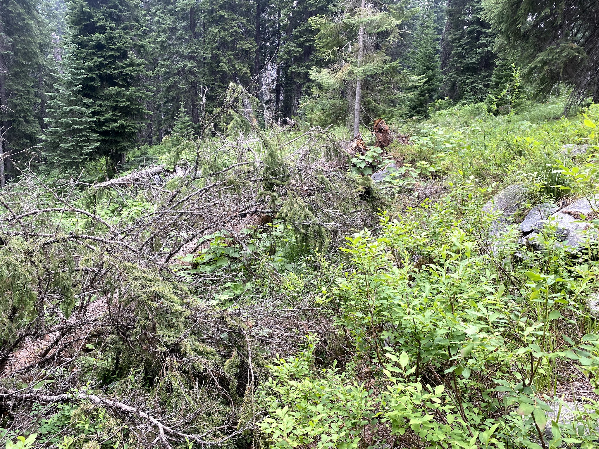
Although I had needed to negotiate some deadfalls, I did notice that a trail crew seemed to have been through the area already, as evidenced by freshly-cut logs. As this was a designated Wilderness, I was acutely aware that the trail crews had been required to use hand tools, and that each pile of sawdust and wood chips represented significant physical effort with saws and axes.
 |
| Once again I said many a "Thank you" to the unseen trail crews whose work had made my walking less difficult. |
I didn't notice the insects as much while walking, but every time I stopped for a rest (usually after about every 45 minutes of walking), it took only a few minutes for me to be swatting them off left and right. It became SOP for almost every rest stop to put on my long-sleeved shirt and the lower sections of my convertible hiking pants, as well as a headnet over my hat to keep them off of my face and neck. Perhaps somewhat perversely, I found myself enjoying watching their frustrated efforts to find some way to bite me, lol. I also became adept at swatting the ones who did manage to bite me - they may have gotten some of my blood, but they rarely got away with it!
I came to another place where I had to ford the creek, and confidently splashed across. This time my gaiters and long pants technique failed me - it was too deep and took too long, and the water penetrated into my boots. As I sat on the other side of the creek putting on dry socks and trying to get as much water as possible squeezed out of my boots before continuing on, I had a light-bulb moment ("Duh! Rain pants!"). I carry a Marmot PreCip parka and pants, but it had not occurred to me to use the pants as an outer layer while fording. I resolved to try that the next time.
Much of this day's walk on the Wind Lakes trail was through more open forest than along Warm Springs Creek. I caught frequent picturesque views of Wind Lakes Creek downhill to my right, and had a longer field of view around me. I also noticed more wildflowers than I had seen earlier, and found myself stopping to take photos of many of them. Perhaps later I'll find the time to try to identify them.
 |
| Long sections of today's trail were more open, climbing through recovering burned areas. |
 |
| I had frequent views of Wind Lakes Creek. |
 |
| The creek was often enticingly close, but the banks were so densely choked with brush that getting down to it to get water (much less to try to fish) would have been a challenge. |


 |
| Indian Paintbrush (Castilleja coccinea). This one I already knew (the common name, anyway) |
 |
| Wind Lakes Creek by one of my periodic rest stops. |
 |
| The trail was not always easy to follow. As the day progressed, it became more and more obscured by brush and leafy undergrowth. I actually lost it a couple of times in the later afternoon and had to scout around to find it again. |


At 1540, I came to a place where I had to ford the creek a second time. My idea to use the rain pants worked perfectly - long pants over the boots first, then gaiters, then rain pants over the gaiters. My socks stayed bone-dry, so I was very happy about that. My happiness didn't last long, however. I came to the trail junction with Saturday Creek, and continued up Wind Lakes Creek toward the junction with Tom Beal Creek. This section of trail, still continuously uphill, became harder and harder to walk. There were a lot of deadfalls to negotiate, and the trail was frequently obscured by brush and very difficult to follow. It was quite clear that I had passed beyond the point reached by the trail crews so far this year.
By the time I made it to the trail junction by Tom Beal Creek, I was done in. I crossed Wind Lakes Creek (fortunately just a shallow walk across stones this time), and came to a decent open campsite just a little beyond it. As much as I would have preferred to sleep under the stars without a roof, the insects compelled me to put up the tent again, as would be the case for the rest of the trip. I got water and settled in for the night at 1930.
By this time I had evolved an informal SOP for operating out of the tent. The tent I took on this trip was a North Face Rock 22. This is a two-person freestanding tent that uses two flexible poles that go from corner to corner and cross in the middle. It has a sort of bathtub of waterproof material that reaches up about 8 inches, with most of the upper part of the tent made of mosquito netting. A rainfly fits over the top and creates protected vestibules on each side. It has a door on each side as well, giving each of two people a place to put their gear and get in and out without crawling over the other person. For one person alone it provides a luxurious backcountry mansion with a storage area for gear outside the back door, lots of floor space to spread out inside, and a covered front porch for getting in and out, cooking, etc. As before, I left the rainfly partially attached but flipped off to the back side of the tent, covering my gear but not obscuring my view, ventilation, or the area in front of the tent.
Because the insects were very persistent and came inside almost the moment the door was opened, I did all my cooking (such as it was) from inside the tent. I'd place the stove outside within reach of the door, get a pot of water on it, and close the door while waiting for it to boil. Even when I did have to open the door, I did it from the bottom so the opening was minimized. When the water boiled, I'd bring the pot in side and set it on something to protect the tent floor, and make the freeze-dried meal and evening mug of green jasmine tea as quickly as possible while the water was hot. The Therma-Rest sleeping pad and its folding chair accessory made this much easier for me than it would have been had I needed to sit up without support. I got very comfortable using this setup as the days went by.
Dinner was Mountain House freeze-dried chicken and dumplings. It tasted good and was very filling, but the dumplings didn't reconstitute as well as I would have liked, so they were a bit crunchy (first world problem). I didn't record when I finally laid back to sleep, but it was undoubtedly as soon as possible after finishing dinner, as I was very tired. Little did I know that the next day would be even harder than today had been.
==========
I awakened with the first light at 0400 as usual, but this time I let myself doze until 0530. I had slept very well, and was not as stiff and achy as I had been the night before. I felt as though the day before had been about all I could do in one day, so I was glad that I felt better this morning. I had breakfast and got as ready as possible inside the tent, then got up and finished packing and preparing for the day's walk. Just as I was preparing to get out of the tent, the sun came up over the mountain. It was a beautiful morning, and I felt very refreshed and ready to get moving.
 |
| My view from inside the tent shortly before getting up to start striking camp and packing my backpack. I always try to site my bed in a way that will optimize some anticipated view, whether of the stars, sunrise, or whatever the location seems to promise. This morning was no disappointment. :) |
 |
| The sun peeking up over the mountains as I strike camp and prepare for the day's walk. |
 |
| The final stage of striking the tent is to pick up the footprint. Sold as a separate accessory, the footprint protects the waterproof floor of the tent from abrasion. It can also be used alone as a groundsheet. |
 |
| This campsite had a convenient fallen tree to sit down and set things on. It also supported a clothesline to air out my socks and sleeping bag. |
I started walking at 0857 (made it before 0900!). My objective for the day was Upper Wind Lake, where I planned to camp and spend a couple of days. The day's hike would be shorter than earlier days, but also steep. What I wasn't quite prepared for was just how many deadfalls I would have to cross. Whenever I stop for a rest I take out my notebook and record the time, mileage, elevation, and some notes about the walk, the trail, the scenery, etc. Today's notes reported deadfall after deadfall, and lots of biting insects.
 |
| This one was a little over waist high. As I recall, I was able to get a leg over it and then pivot around, swinging the other leg over as I straddled the smooth part in the middle. |
 |
| I don't remember how I got past this one, but you can see the trail going right under it. |
 |
| They seldom look as daunting in the photos as they are when you have to cross them. But as I came upon this one only minutes after negotiating the last one, I remember thinking "Seriously? Another one already? *Sigh*". If you can picture Gandalf's face in Moria when he first saw the Balrog, you'll have an idea how I felt. Except that here it was the fallen tree saying "You cannot pass!" |
I kept hiking up towards the Wind Lakes, resting periodically. I stopped for lunch and actually fell asleep for about an hour, so I guess I needed the break. I finally reached Lower Wind Lake, which was a milestone and felt like progress. It was only a short, albeit steep, remaining hike to get to Upper Wind Lake where I expected to camp.
 |
| My first glimpse of Grave Peak, which overlooks the Wind Lakes. There is an abandoned Forest Service lookout station on top, barely visible in this photo as a tiny bump at the apex. |
 |
| Lower Wind Lake. The trail continued past and climbed around and upwards to Upper Wind Lake. |
I reached the upper lake at 1350 and found my campsite by 1400. I relaxed in my camp chair, thinking about what I would be doing here for the next 1 1/2 days. I had hoped that the lakes would live up to their name and be windy enough to blow the insects away, but I had no such luck. So I set up the tent and then enjoyed the surroundings for awhile.
 |
| My campsite for the next 1 1/2 days. Before unpacking and setting up, I sat against the tree by my pack and just relaxed and enjoyed the setting. |
 |
| The view from my campsite looking north along the western shore of Upper Wind Lake. |
 |
| Grave Peak, directly east across the lake from my campsite. The lookout building is visible as a small bump at the top of the peak. |
 |
| The view to the southeast, continuing to pan around the lake. |
 |
| The view to the south of my campsite, the southern shore of Upper Wind Lake. |
Eventually it was time to go through my evening routine of making dinner and preparing for bed. Today's dinner was Beef Stroganoff from a different company (Peak Refuel). It was ok, but I didn't like it as well as the Mountain House version. Beef Stroganoff was the only meal from this company they had in stock at REI that even remotely appealed to me - the rest were all ethnic dishes in which I had no interest. But the Peak Refuel website does show a wider selection, so perhaps REI was just trying to broaden the variety and conserve shelf space by minimizing the overlap with the Mountain House menu.
I was quite ready to go to sleep, enjoying the prospect of a day without striking camp and moving on.
It was a beautiful, cool, brilliant starry night, and I slept well. Unfortunately the insects kept me inside the tent. Although I could still see the stars and feel some of the breeze, it's just not quite the same. I probably could go outside for much of the time and go back in when the bugs become pesky. Perhaps I'll start recording the hours when they are active, and see if perhaps I might be able to see the stars clearly again for at least a few hours. I did get up at one point during the night and stood there for awhile looking at the stars. I saw the Milky Way quite clearly, as well as the same three planets as I'd seen before in June: Neptune, Jupiter, and Saturn, all lined up in the southern sky. The Skyview app also showed Pluto directly in the same line with the others, but I could not see it with the naked eye.
I got up at 0545 and went through my morning routine, but made preparations for a different kind of day than I'd had up until now. Today I did not break camp, but instead packed a day pack for a special excursion. Having examined the map and read about this area beforehand, I had decided that if it was as beautiful as it promised to be from the map and photos I'd seen, I would take this opportunity to scatter a portion of my father's ashes on the summit of Grave Peak. Today would be the day to do that.
For this day's hike, I used an Eddie Bauer "Stowaway" pack that I originally bought for traditional vacation travel, and have often packed in a suitcase so I'd have a day pack to use at our destination. It has proven very useful for backpacking, as well. I got the idea to use it from another backpack I have that has a large rear outside pocket that detaches and doubles as a day pack. My new pack does not have such a feature, so I took this one on my trip in June. I found it very useful for spending the day away from my campsite fishing, as well as for trips to the creek to get water (it holds all my water bottles and my Steripen very conveniently). It is one of the items I had removed from my pack to save weight, but it eventually snuck back in as I reconsidered. Now I think that its place in my pack is secure, as it has more than proven its worth.
 |
| This Eddie Bauer "Stowaway" daypack is handy for day hikes and other tasks away from camp. |
 |
| The pack folds into its own top zipper pocket to form a compact package. I should try it as a pillow. |
Because I was leaving my campsite unattended for the day, I put the rainfly over the tent and secured my food and a few other items from being pillaged by critters. I carry my food in bear-proof bags called "Ursacks" by a company named...Ursack, lol. They are heavy-duty stuff sacks made of Kevlar, with a thick rope to tie them closed. If used as per the directions (you have to tie the knot a certain way), they cannot be stolen or torn apart by bears or other camp-robbing critters. The idea is that you put all your food and other odiferous items (e.g. deodorant, lotions, or anything that might smell like food) into these bags, and then secure them to a tree or something away from your campsite. I go one step further, and store all the food inside the Ursacks in OpSaks. The name stands for "Odor-Proof Sack", and they are made by the same company. The company claims that these bags are 17,000 times more impenetrable to smell than regular plastic bags. So if all the food is in these bags, the critters should never even be attracted to them in the first place.
I feel very secure with the food in the OpSaks, and rarely bother to secure it away from my campsite. I prefer the convenience of having the food close at hand and not having to go and retrieve it when I want it. But I use the Ursacks anyway, as they are a convenient storage bag and I can secure them if I feel the need (most wild creatures shy away from humans, but some places have extra warnings about problem bears that associate humans with food). In this case I didn't want some critter to become emboldened by my extended absence, and decide to tear things up while I was gone for the day.
 |
| My tent with the rain fly in place. |
 |
| My Ursack food bags, securely tied to a tree. |
 |
| This saddle was approximately halfway up, and offered the first views of the mountains to the east. Unfortunately it was a very smoky day, a frequent occurrence here in August due to wildfires. |
 |
| A view of the summit from a little over halfway up. The trail climbs up and along the slope to the right out of the frame of the photo, then crosses over and follows the other side of the ridge leading up to the summit. |
 |
| This section was typical of most of the trail leading up to the summit. |
 |
| The last part of the trail became more difficult. The trail, such as it is, is visible starting in the lower right of the photo and continues up following the side of the ridge toward the top. |
 |
| Finally, I stood about 20 feet below the building, wondering how I was supposed to get up to it. I could find no trail at all, so I finally just scrambled up there over the rocks. |
 |
| The view straight back down after I scrambled up. It never seems to look as steep in a photo. |
 |
| I made my way out onto the rocks along the ridge top to get a photo of the lookout structure. |
 |
| The view to the north, showing Colt Lake. |
 |
| The view to the east, with a partial view of one of several unnamed lakes. |
 |
| This view to the south with two unnamed lakes was taken from the trail below the lookout. |
 |
| The view to the west-southwest, showing the Wind Lakes. My campsite is visible at the southwest corner of the upper lake, if you know just where to look. |
 |
| My dad's marker in the veteran's cemetery near Des Moines, Iowa. |
 |
| The summit marker on Grave Peak. Now there's a part of him here as well. |
I awakened at 0415 for an early start. I enjoyed the beautiful morning and the peaceful setting, admiring the view of the lake and Grave Peak as I packed up and got ready to walk for the day. Today's plan was for a long day's walk on a good trail, with a fairly steady downhill trend throughout the day. But that was not how the day was going to play out.
I started off just after 0730, energized and happy, looking around and appreciating the scenery around me as I walked down the trail. Unfortunately, I was admiring a small pond on my right as I passed the un-signed trail junction on my left, and I missed the turn. Eventually I realized that I was going downhill a bit faster than expected, and also that the terrain in front of me did not match what I was expecting. I discovered my error, and turned around to climb back up, regaining my needlessly-lost 200 feet of elevation (one "Shiras", lol). I resolved not to let that false start spoil my day. I thought of it just that way - like a false start in a race, you have to shake it off, get over it, and focus on the task at hand. So I headed off in the right direction, enjoying the morning.
 |
| Still taking photos of my pack at trail junction rest stops, lol. This one is at the junction of the trails to Friday Ridge, Saturday Ridge, and back to Wind Lakes. I was headed for Saturday Ridge. |
I walked steadily, with occasional rests, until 1215. The trail had a bit more up and down than I'd expected, but nothing extreme and it was pleasant walking. At 1215 I stopped earlier than I'd planned, because I was about to enter a fairly recent burn area, and wanted to rest in the shade. I couldn't see the end of the burn from where I was, but it looked pretty extensive.
 |
| The beginning of the burn area. I had never walked through one quite as recent as this before. It was a bit eerie, almost like a graveyard or something. |
 |
| I found myself fascinated by the devastation, and also by the signs of returning life. I wondered how long ago it had burned, and how long it takes to recover. |
 |
| I didn't notice it right away, but in the background are two plumes of smoke from spot fires on the next ridge to the south. |
I was so transfixed by the spectacle of the burned forest that I wasn't paying close enough attention to the trail, and wandered off of it somehow. This was in part due to the trail's not being especially heavily-used, but also to the fact that the burn seems to have created a lot of "false trails" - bare traces on the ground that resemble trails, but are really just the remnants of burned/decayed trees or something. The ground was fairly open and bare in every direction, and I was unable to detect where the actual trail was, or where I had stepped off the designated track.
At this point the correct procedure would have been to backtrack to the last point where I was certain I was on the trail. This is one reason why you should periodically turn around to look behind you and study your backtrail - so you know what it looks like in case you have to retrace your steps. This is especially important in an area where the trail is sketchy, and it is normally an ingrained habit for me to do. But the burn area was so novel that I didn't even think to turn around and go back. I had a Forest Service map as well as my GPS, and was quite confident I would run across the trail again if I just went in the right direction. I checked the GPS, saw that I was somewhat south of the trail, and so headed off angled in that direction, expecting to cut across it soon.
After walking awhile without coming across the trail, I checked the GPS and saw that I had apparently crossed back over it some time ago, so I angled back in the other direction. The bare, open, relatively level terrain gradually became steeper, with thicker underbrush that made it it more difficult to walk, and harder to see the actual ground. There also began to be more fallen trees, many of which were concealed by the beargrass and other undergrowth in the recovering forest. After quite a long time of walking in what was generally the right direction, angling back and forth up and down the slope and repeatedly crossing the pink line of the "trail" on the GPS with no sign of the trail on the ground, I took a close look at the Forest Service map to see what it would show me. As it turned out, of all the places on the entire trip, the Forest Service map and the map in the Garmin GPS disagreed on the exact location of this particular section of trail. The Forest Service map showed the trail much lower down the mountain (several hundred feet in elevation from where I was by this time). I had to decide whether to head straight downhill (south) and try to cut across the trail where the map showed it to be, or to continue to head in the direction of my next goal, the trail junction of the Saturday Ridge and Warm Springs trails.
As I didn't really know for sure which map was correct (all I really knew was that I was *not* on the trail), I decided that the best course of action would be to take a bearing on the expected location of the trail junction and head more or less straight for it. This would eventually take me across the expected trace of the trail as shown on the Forest Service map, while moving me in the right direction and not wasting time just trying to find the trail.
This was an important decision for two reasons. First, the hiking had become quite difficult and potentially dangerous. Because I was on a relatively steep slope with a fair amount of hidden obstacles and could not be certain of my footing, I had to proceed very slowly and carefully to avoid wrenching an ankle or a knee. Additionally, I had started the day with my standard walking load of 2 liters of water in my Camelbak and one liter in reserve in a Nalgene bottle. I have the capacity to carry up to eleven liters of water if I fill every Nalgene and both two liter Platypus collapsible bottles. Three liters was a perfectly adequate amount for my expected walk, but did not give me a large margin for the situation I was now in. So I needed to be making progress towards the trail junction and the creek I expected to find not far beyond.
In the end, it took me all afternoon. I made my way slowly and carefully, navigating using compass bearings and landmarks as we had learned (the hard way) at Officer Candidate School at Fort Benning. When walking on a slope, if you try to simply follow a compass bearing, the terrain will relentlessly cause you to drift downhill off course, despite your best efforts to walk in a straight line. The only way to prevent this is to take a careful bearing on a prominent landmark in the distance (e.g. a distinctive rock, tree, or other feature), and then walk to that object. Once there, you take another bearing and fix a new landmark, then walk to that one, etc. In this way you can ensure that you don't wind up wandering off course in a generally-downhill curve.
At OCS in 1980-81, couple of fellow soldiers and I had learned this the hard way on the night land navigation course at Fort Benning, when our attempt to simply follow the compass caused us to end up enmeshed in a nearly-invisible barbed wire entanglement that was also overgrown with what we called "wait-a-minute vines". After spending a couple of hours finding our way out of it and establishing our position by terrain association, we started sending one man ahead of us a hundred yards or so, where he would blink his (red-filtered) flashlight back at us. We would then signal him to move to his left or his right until he was directly in line with our intended course, and then make our way to his position. Lather, rinse, repeat.
Fortunately for me, it was not dark, so I was able to pick out distinctive landmarks and use this technique by myself. Finally, at 1700, I ran across the trail and was able to begin following it. I came to the expected trail junction shortly after that, and at 1730 I came to a small stream where I was able to stop and fill up on water. At this point I had just about one swallow left in my Camelbak. It wasn't the longest I've gone while needing to find water (I've walked for half a day with dry canteens at least once that I can remember), but I would never do it intentionally, especially when negotiating difficult terrain. My relief was palpable.
 |
| Finally, the trail marker I'd been looking for. |
 |
| Running water - a very welcome sight. |
Having taken all afternoon to move only half a mile on the map, my plan for the day was shot. After a long rest at the little un-named stream collecting and treating enough water to quench my thirst and carry three liters with me, I started off again at 1830. My revised objective was to get to Warm Springs Creek and find a decent place to camp. Although I was on the trail again, it was blocked by a great deal of deadfall and progress was slow. I finally came to Warm Springs Creek, found an acceptable place, and set up camp around 1930 or 2000.
Monday morning I was up at 0430 and on the trail at 0835. The Steripen had failed the night before, displaying a frowny face and a picture of a light bulb. Although it looked fine externally, I cleverly deduced that the bulb had failed. It was way too early for this (it's supposed to last for 8,000 uses), but warranty discussions would have to wait until I got home. From this point on it would be either boil the water or risk Giardia Lamblia, Cryptospiridium, or some other nasty bug that could make me ill. I had six liters treated for the day, which would easily get me to my next destination, the confluence of Warm Springs Creek and Wag Creek. I had already camped on the far side of this confluence on my way in, and would have to ford the creek to keep walking out to the trailhead. The decision whether to do this at the end of the day or camp on this side and ford in the morning would have to wait until I got there.
My notes for this day's walk include many references to deadfalls, which on this section of trail were positively diabolical. As an Army combat engineer, I was trained to place obstacles in the likely path of an enemy advance, siting them where the terrain would make it most difficult to clear or bypass them. As the day wore on, I began to imagine that some malevolent intelligence had purposely blown down some of these trees with similar considerations. I swear I could not have chosen "better" spots for some of them if my objective was to slow down a person trying to hike the trail.
 |
| I took this photo while halfway through making my way around the fallen tree. The trail is not visible here - it goes from left to right on the other side of the root ball, down below that tangle of dead branches. |
 |
| This one fell directly over a stream with a soft, muddy bottom. Too high to get over and too difficult to get around. I ended up crawling under it while trying to remain dry and not get hung up by my backpack. |
 |
| Looks like I am not the only one to have gone under this fallen tree. Turns out it's difficult to tell from the photo, but it's the paw print of a black bear. |
It was a lush, green, moist forest with a lot of boggy areas and marsh-type plants, and the humidity was high. It was still pretty hot, so I spent most of the day drenched in sweat, although by afternoon it had clouded up and even started to sprinkle a bit. At least my mental soundtrack finally changed from interminable repeats of the Rolling Stones' "Beast of Burden" to "Singin' in the Rain". :D Lest this sound like whining, I was not at all unhappy. I was enjoying a week of complete solitude in a beautiful, remote, wild place. I found myself periodically laughing out loud at the discomforts and inconveniences, shouting "WETSU!" (We Eat This Shit Up) to the forest at large as I confronted yet another well-placed obstacle to my progress. Gotta maintain a sense of humor, lol.
 |
| This one elicited another "Gandalf" moment. You can see the overgrown trail disappearing under this monstrous tangle. And there is already another one in sight, just down the trail. |
On a technical note, the smoky and cloudy conditions, combined with today's dense forest cover, had limited the effectiveness of my solar panel in recharging the storage battery. Using the GPS to navigate while bushwhacking had sapped its battery more than usual, and I was starting to watch my remaining electrical charge very carefully. It finally occurred to me for the first time (Duh!) to turn off the backlight on the GPS during the day. That helped a lot, but I still had to watch my power consumption pretty carefully.
I came to the confluence of Warm Springs Creek and Wag Creek at 1715. Just before it was a large level area that would make a good campsite. Even though I knew there was also a good campsite on the far side of the creek, I decided to wait and ford it in the morning. I was confident in my fording technique, and thought it would be more interesting to camp in a different spot. I also knew that I was OK to camp on this side, as Teresa had texted me earlier in the day telling me that the Forest Service had said I didn't need to be concerned about the fires I had seen.
I put up the tent, as the biting insects were still a pesky, persistent presence. As it turned out, the only night I slept without some kind of a roof had been the first night. I missed the clear view of the stars but was grateful for the protection of the netting. I went to the creek for water, expecting that I'd bring it back to the campsite and boil it for drinking. But as I stood there looking at the beautiful cold, clear mountain stream, I thought "no way", and simply dipped in my cup and drank deeply. It was deliciously cold and refreshing, and I knew immediately that this would be my new SOP. Just I as I always did back in the 1970s, I will drink any cold, clear, running water that I believe to be uncontaminated, and only treat water that I have reason to believe may be suspect. This decision was very liberating and made me feel even closer to the wilderness than I had up to this point. I returned to my campsite, had a relaxed, leisurely evening, and went to bed.
I woke in the early dawn (0445), made breakfast, and doctored my feet. The long days of downhill hiking, and especially the afternoon of bushwhacking on Saturday Ridge, had beaten up my feet pretty thoroughly. Between Band-Aids, moleskin, and Band-Aid blister gel (a neat invention that creates a sort of artificial blister over a hot spot before it turns into a real blister), I was not in bad shape - I just needed some maintenance. My right big toenail, however, had taken some real punishment and was done for. I had known for some time that I was going to lose it - it was just a question of when. At this point it was so loose I decided to just take it off. This was a good decision as it eliminated the pain and made walking much less uncomfortable. The left one wasn't looking good, either, but wasn't yet ready to come off. (Brief fast forward - despite my best efforts to keep them clean, I suspected a developing infection and went to the urgent care facility when I got home. The doctor told me that the same thing happens to him every year when he goes hunting in these mountains, took off the left toenail, and prescribed antibiotics).
As I packed up to get ready to leave this last campsite and walk out to the trailhead, I was feeling exuberant. In spite of (or perhaps even partly because of?) the difficulties, this trip had been an excellent wilderness experience. I felt reaffirmed in my ability finally to be able to get out here again after so many years, and just generally felt a pervasive sense of peace, fullness of spirit, and well-being. Just at the moment when I was feeling this most deeply, the sun peeked over the mountain through the trees. The feeling was more than I could keep inside, and I cut loose with an Indian war whoop, followed by a rebel yell. There is something exceptionally liberating about doing this in a wide open place where there is nobody there to hear but the mountains and trees, and the echo soon gives way to the sounds of wind and water or just silence. It was Whitman's "barbaric yawp" made manifest. As on other occasions when I've felt this way (more than once I've literally howled at the moon), it left me with a deep sense of contentedness and satisfaction. Life is good.
I started walking at 0830, and immediately came to Warm Springs Creek. My attempt to ford it with dry feet was an epic FAIL. It was too wide and too deep for my rain pants/gaiters/long pants technique, and before I was halfway across I felt my socks getting wet as the water seeped around the layers. I stopped on the other side to dry everything out. This ended up taking over an hour, because the boots (which have a layer of Gore-Tex in them to make them waterproof from the outside) have a layer of foam cushioning inside that absorbs water and then takes time to dry. I think I have finally perfected a technique for drying them as quickly as possible, but it would be better if they stayed dry in the first place. Back to the drawing board for the next trip. I started off again at 0942.
I crossed over some of the same deadfalls I had already seen a week earlier on my way in, until I came to the junction with the Wind Lakes Trail. Then suddenly the deadfalls were gone from the trail. Another trail crew had clearly come though since my first time on this trail a week earlier and cleared out most of the remaining deadfalls, and it made a huge difference in my progress through the day.
 |
| Hooray! A trail crew had cleared the deadfalls (well, most of them). I said many a "thank you" as I passed similar scenes on my way down to the trailhead. |
I began to establish a steady walking rhythm, and even began hearing "Jodies" in my mind. Jodies are military marching cadences that help keep everyone in step and pass the time while on road marches. Apparently "Jody" was the guy who stayed at home when you went into the service, and now he's got all your stuff (as in: "Ain't no sense in looking back, Jody's got your Cadillac" and "Ain't no sense in going home, Jody's got your girl and gone", etc.).
I was happily marching down the trail enjoying the scenery when a sudden movement ahead of me on the trail caught my eye. It was a fairly large black bear, hurrying off in the opposite direction. I quickened my pace and tried to get out my camera, but it was too fast for me, and disappeared into the brush on the side of the trail after only a few yards. I realized that it must have been walking towards me on the trail, unable to smell me because I was downwind. It saw me first, and turned around and ran away immediately (as every bear I have ever met in the wilderness always has done - I think this one was number six or number seven). I stopped briefly on the trail to create a GPS marker on the spot and then continued down the trail, calling out into the thick brush "Hello, Mr. Bear, I'm just walking right on by! No need to feel threatened, I'm just passing by!", etc. That may sound a bit silly (he was probably a couple hundred yards away by then), but there's no sense taking chances. I carry a Kimber Camp Guard 10mm pistol loaded with G9 Woodsman ammo in a Wilderness Safepacker holster, but I'd really hate to have to use it, if passing by without incident is a viable alternative.
I spent the rest of the day walking out, enjoying the same scenery as I had on the way in, but from the other direction. I stopped and admired the view of the waterfall and the creek far below, and again at the boundary of the Wilderness. Eventually I came to the hot springs, where I saw the first people I had seen since the day I had started in. I reached the trailhead at 1630, loaded up the car, and started the long drive home.
 |
| The bridge over the Lochsa River to the highway and the trailhead parking area was a welcome sight. |
As before on my trip in June, I had a number of "Lessons Learned" from this trip. I'll have to think about the following things for next time:
1. The switch to freeze-dried dinners was a resounding success, far better than my earlier menu.
2. My lunch menu of tortillas, peanut butter, and honey is unsatisfactory. It's heavy and I don't really like it that much. I think I'll probably go back to soup and crackers.
3. Taking the tent was a good decision, but at 7.5 lb. with poles, stakes, and footprint, the North Face Rock 22 is too heavy for backpacking. I need a lighter tent.
4. The Therma-Rest classic sleeping pad and chair combination was a *huge* success. It made sleeping and sitting up much more comfortable. I will definitely keep taking this along.
5. My fording technique is inadequate. Next time I will go back to using my camp shoes/water shoes and putting my boots in the pack to stay dry, as I used to do when I was younger.
6. Navigation through a burn area can be challenging, and the map in the GPS does not always have the correct trace of the trail. I need to be more careful and aware, and backtrack and find the trail rather than simply setting out towards where it "should be". (I knew this already, but sometimes need to re-learn things the hard way).
7. Turn off the backlight on the GPS to save battery power.
8. Despite all the dire warnings and recommendations to treat all the water for drinking, it's usually not necessary once you're out in the wilderness. Henceforth I will drink clear running water that seems unlikely to be contaminated, and will treat only water that is suspect (lakes and ponds, areas where cattle are allowed to graze, heavily-travelled areas, etc.). Let's hope I don't learn differently the hard way, lol.
9. Although I had reduced the weight somewhat, my pack was still too heavy. A few items I had removed for weight savings after the Lemhi Range trip snuck back into the pack before I left for this trip. I need to take another look at which items I can leave behind, and have the discipline actually not to take them.
10. This lesson was going to be: "The Steripen is not be as reliable as I thought" - but wait! a) I called the company and they immediately shipped a replacement. So the warranty is good. b) I read somewhere that the bulb failure message can be erroneous, and actually result from an anomaly caused by a completely-discharged battery that sits for a long time (as mine had done for over a year). So I recharged the battery to a full charge again, and the "failed" Steripen started working properly. Lesson learned. :)
Mood: Content
Music: Neil Young, "Old Man"
posted by Brad @ 13:25
8 comments
![]()
![]()


8 Comments:
"With that introduction, here is a map of my trip using Garmin Connect" <== "It looks like you don't have access privileges to view this activity."
Awesome and mesmerizing account -- thanks so much for sharing.
So enjoyed reading this Brad! What a wonderful adventure and such a special time for you on “ Grave Peak”! Am sure your Dad was smiling and was totally with you on that mountain peak! ❤️J & C
Brad.
Thank you for the narative.Once again you have taken me back to when I used to spend many wonderful days alone in the mountains.
That was quite the hike! Awesome. I loved reading all the details
That was quite the hike! Awesome. I loved reading all the details
That was quite the hike! Awesome. I loved reading all the details
Very well written Brad! Excellent account of your adventure, both the good and the bad. I came close to venturing out that same trail this summer but didn't make it out there. My husband and I backpacked into the Tom Beal/Colt Lake area years ago. Thank you for sharing your story.
Post a Comment
<< Home