Backpacking in the Frank Church Wilderness, Idaho
In August, I went on my last extended backpacking trip of the summer. This time I went to the Frank Church River of No Return Wilderness, which at 2.3(+) million acres is the largest contiguous designated wilderness area in the lower 48 states. That is only part of the story, however. It is directly adjacent to the 206,000 acre Gospel-Hump Wilderness, and is separated from the 1.2 million acre Selway-Bitterrroot Wilderness by only a primitive mining road. Together, they comprise an area of almost four million acres of designated wilderness area that covers a huge portion of central Idaho.
The name "River of No Return" makes it sound somewhat sinister, but it didn't get that name because people don't come back. The Salmon River, part of the national wild and scenic rivers system, acquired the nickname "River of No Return" because it is so rough and rugged that while it can be traveled downstream, it was virtually impossible to travel back upstream before the advent of powered boats. The Middle Fork of the Salmon River lies completely within the Frank Church Wilderness.
My trip was originally planned for 10-20 August, but I slipped it forward a few days on the calendar to give myself a little more recovery time after the 7-8 August Appleseed shoot. The final planned dates were for 12-21 August. I had intended to go to the Bighorn Crags, well-known as one of the most spectacularly scenic areas in the wilderness, filled with high rugged peaks and numerous alpine lakes. This had been my plan for two years, but I had to change it the week before I was scheduled to depart.
In addition to reading books about the various areas where I want to hike, consulting the Forest Service websites, talking to the rangers, and obtaining topographic maps, one of the resources I use in planning my trips is the Idaho Fire Map, maintained by the Idaho Department of Fish and Game. Although the U.S. Forest Service websites contain information on wildfire closures, it is inconsistently organized and is usually posted as written bulletins naming roads and areas closed to public access due to wildfire. While this may be useful for locals or people already familiar with the area, I find it difficult and time-consuming to ascertain exactly where I can and cannot go using these notices. The IDFG map posts the information graphically, making it much easier to determine the specific roads that are closed and the exact boundaries of area designated as off-limits for public use due to wildfire.
As you might have guessed by now, the week before I was to depart, I checked this map and discovered that the access route into the Bighorn Crags had been closed, and I would be unable to get into the area. I began looking for alternate areas, and considered a number of different places around the state where I would like to go backpacking eventually. I checked five or six different places, including other places in the Frank Church Wilderness, the Gospel Hump Wilderness, an area along the St. Joe River, and the Selkirk Mountains in North Idaho (reported to be the wettest mountains in the state). Each place that I decided would be a promising candidate for the August trip turned out to be closed as well. Finally I found a place in the Frank Church Wilderness with no fire closures, and established that as my planned destination. I went through the rest of my planning again, folding and marking the map, establishing waypoints for the trailhead and possible campsites, etc. All packed and prepared, I set it aside and concentrated on the Appleseed shoot.
The day before I planned to leave, I made a final call to the USFS ranger station to check on trail conditions and "anything else I ought to know". They told me that a fire had been spotted three days ago, and that they had just issued an evacuation order for part of my planned route the day before. Wow. I went back to my book and asked about a different possible route about 20 miles east of there. The ranger told me there were no fires or fire-related closures in that area, so I made another change to my planned itinerary. Fortunately I already had the map for this area, and it only took a couple of hours to re-do the route planning, waypoints, etc. I decided to let the trip slip one more day, to 13-22 August.
I departed very early on 13 August to drive the approximately 450 miles to the trailhead. The first 420 miles of my route included I-90 east from Coeur d'Alene to Missoula (a beautiful trip in itself), US-93 south through the Bitterroot Valley, up over the Continental Divide, and down the Salmon River Scenic Byway in Idaho (another beautiful and historic drive). I followed this route west on Idaho 75 to the mining ghost town of Sunbeam (about 12 miles east of Stanley) where there is now a cafe located at the intersection with Yankee Fork Road. Yankee Fork Road is an improved gravel mining and forest access road, on which began the last 30-mile stretch of my journey to the trailhead.
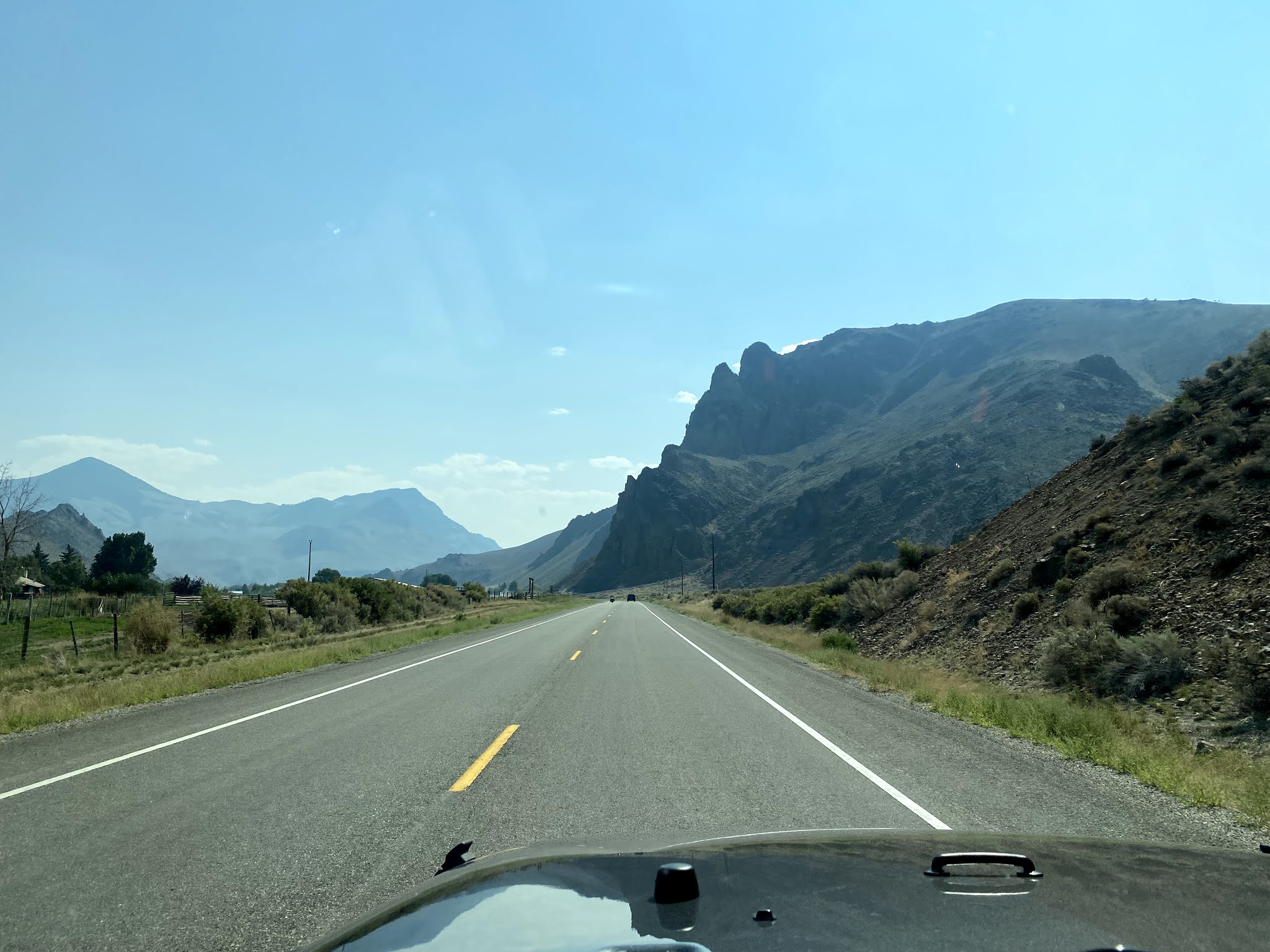 |
| Along the Salmon River Scenic Byway south of Challis, ID. As with my trip in July along US Highway 12, if I'd stopped for every photo opportunity I'd still be on the road. |
 |
| Something you don't see every day in the USA - a Bailey Bridge. We learned to build this WWII-vintage assault bridge during the Engineer Officer Basic course at Ft. Belvoir, VA, and built one annually while stationed in Germany, during our annual "Bridge-Ex" refamiliarization training. |
 |
| The locations where I built Bailey bridges while in the Army were considerably less scenic. |
 |
| There were numerous decaying log cabins along Yankee Fork Road, including the ghost town of Bonanza. |
 |
| The Yankee Fork gold dredge is now a historic site. |
About ten miles or so up Yankee Fork Road, I turned off onto Forest Road 172 for the drive to the trailhead. This involved a long climb and subsequent descent over Loon Creek Summit on a narrow, winding gravel road. The Wilderness Gateway is at the summit, although you can continue to drive down to the Loon Creek guard station. I never was quite as clear on when I actually crossed the wilderness boundary as I had been in the Selway-Bitterroot Wilderness.
 |
| The sign at the turnoff to Forest Road 172. There is a guest ranch next to the guard station, one of several private operations that were grandfathered in when the Wilderness was created. |
 |
| A view back south down Yankee Fork from partway up to the Loon Creek Summit, showing an active mining operation in the distance. |
 |
| This sign was at the summit. I believe this is the actual wilderness boundary, although the road is a corridor to permit driving to the ranch and the guard station. |
 |
| Another sign at the summit. This was the longest distance so far that I'd driven off the highway in order to get to a trailhead. This road was well-traveled and maintained, so the winch, hi-lift jack, and other off-road tools and supplies I'd brought along were not really necessary. |
 |
| On the road down the other side. You don't want to let your attention wander while driving these roads! |
 |
| Parked at the Loon Creek guard station, ready to set off on foot. The trailhead is on the other side of the station grounds, leading up into the mountains in the background. |
I arrived at the Loon Creek guard station at about 1845, talked to the ranger there, and prepared to set off on foot. The following is a summary of the walking portion of my trip:
I registered at the trailhead, and started hiking up the trail at 1935. The ranger had told me about a small tributary stream not far up the trail where I could stop for the night, get water, and prepare for the next day's hike. It turned out to be less than a mile to where the stream crossed the trail. I found a relatively level place to camp and got set up around 2030. There were not many insects so I didn't set up my tent. I got water and made dinner about 2230. I was very tired from the long day, and went right to sleep.
I awoke at 0520 after a somewhat fitful night. Although I'd slept on the most level ground I could find, it was definitely not flat, and I spent much of the night feeling like I was about to roll over. It was light enough for me to sit up and start doing things by 0600, and light enough to read the map by 0630. I saw Jupiter in the sky, but the air was too hazy to see many stars or the other planets I'd seen before.
 |
| My campsite, after breakfast and midway through packing up to go. This time I used the tent footprint as a groundsheet underneath the space blanket. |
Although I did not set it up this first night, I had researched and purchased a lighter tent since my previous trip. The top-rated tent was from a company called "Big Agnes", but unfortunately it was red in color, which disqualified it (in my view) for use in the wilderness. I consider it rude and inconsiderate to others to wear or use brightly-colored clothing or equipment in wild places, and strongly prefer to minimize visual pollution, blending into the landscape with earth tones as much as possible. The tent I chose was the second one on the list of Backpacker Magazine "Editor's Choice" tents, the Nemo Dragonfly 2 backpacking tent. Having read about it and decided that I wanted one, I then found it impossible to find in stock anywhere. Various manufacturing and supply chain issues, coupled with the surge in outdoor activities due to COVID-19 restrictions, have created a lot of challenges for outdoor equipment companies trying to meet the demand for their products.
Fortunately for me, an astute employee at the Spokane REI knew that Nemo makes a version of this tent that they call the "Bikepack" version. It is identical to the backpacking tent except that the poles come in smaller sections and the stuffsack is different, in order to optimize it for carrying on a bicycle. It is also more subdued in color than the somewhat-too-bright-green backpacking version, all the better for my taste. Unlike the backpacking version, it was in stock and I could buy one. :) The Nemo Dragonfly 2 Bikepack Tent is a 2-person tent made of extremely lightweight materials, somewhat smaller than my North Face Rock 22 but still very roomy for one person. I ordered this tent and the optional footprint in time to become familiar with setting it up and to bring it on this trip. Including stakes, poles, and footprint, it weighs only three and a half pounds, saving me four pounds vis-a-vis the North Face tent. Using the foot print as a groundsheet even without the tent gives me a nice working area that I can keep relatively clear of dirt, pine needles, etc, and as it is staked out and has grommets for the tent poles, would give me a head start on setup if I needed the tent in the middle of the night due to unexpected conditions.
For many, many years, a standard part of my equipment for almost any hike or camping trip has been a Space Blanket. This is a very tough and durable laminated tarp made of polyethylene and mylar with a reflective layer of aluminum, and grommets in the corners in case you want to use it as an emergency roof or windscreen. I've used these since the late 1960s or early 1970s, whenever they first came out as a civilian product spinoff from the development of astronauts' space suits. Of course, back then everything even remotely connected to the space program was marketed as such (remember those awful "Space Food Sticks"?), so this became a "Space Blanket". Commercial versions are usually red or blue, but if you look you can find it in olive green. The Army calls it a "casualty blanket" due to its waterproof nature and insulating qualities. Whatever you call it, it's extremely useful, coming out at every rest stop for me to sit on and going under my sleeping pad at night.
At 0730, while I was finishing breakfast and packing up, the sun came up over the mountains illuminating the peaks in the distance. The mountains were beautiful, with many-colored rocks and jagged, pointed crags, promising some really spectacular scenery in the coming days. I started walking at 0840.
 |
| The early morning hike promised a well-maintained trail and beautiful scenery to come. |
 |
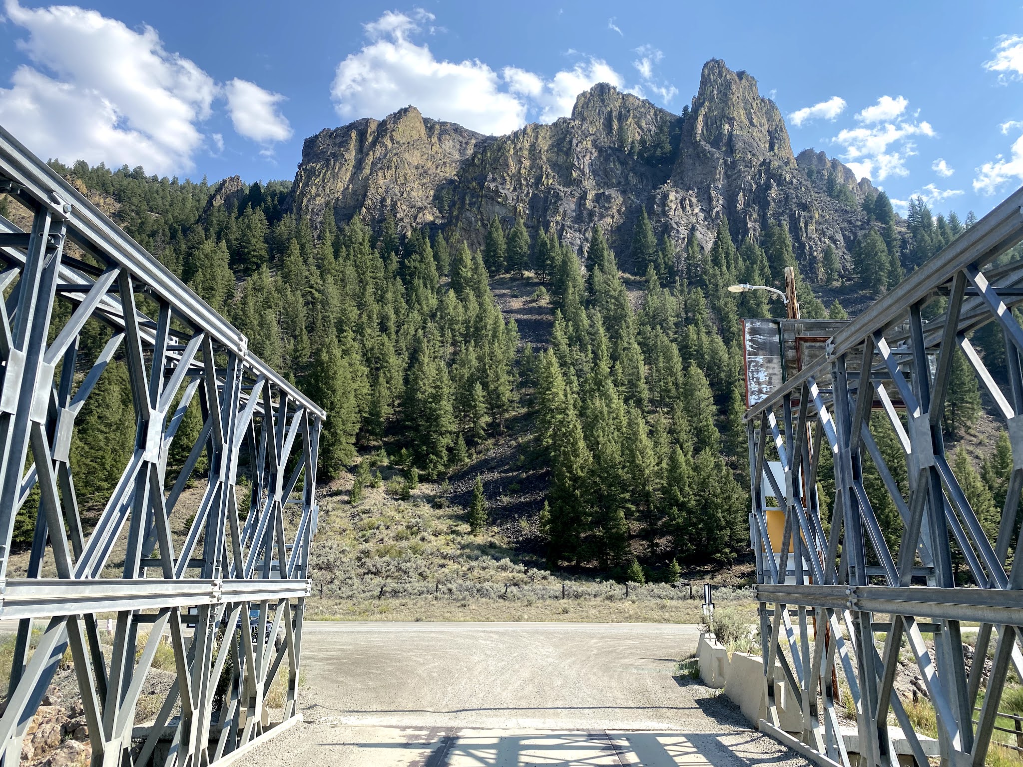
| I would be hiking up the Loon Creek Canyon in the center of the photo, climbing slowly up and around the mountain on the right up to Horseshoe Lake and the Knapp Creek Divide. |
 |
| Woodpeckers had been busy on this tree. |
 |
| This sign points in two different directions, even though by all accounts the Loon Creek Trail leads to the Knapp Creek Divide. |
 |
| The main trail goes straight ahead from right center, past the sign on the tree. If you look carefully, you can see a much fainter trail angling off to the left from the left center. |
Having given my land navigation skills yet another unexpected workout, I continued on. I came to an expected ford of Loon Creek at 1055, and crossed it wearing my camp shoes and neoprene socks, with my boots and hiking socks in my backpack. This worked very well, and will be my SOP for stream crossings unless the footing looks unusually treacherous and I feel like I need the ankle support of my hiking boots. In that case they'll simply have to get wet. I stopped directly across from the ford to let my feet dry out, and decided to go ahead and have lunch while I was there.
Lunch on this trip was different than it had been on my previous trips this year. I had decided to go back to soup and crackers. Even though this requires water and time for cooking, I had always found this to be a satisfying lunch. In my younger years I had used bouillon cubes and rice to make the soup, but I had decided I wanted more variety. Unfortunately almost all the dried soups that I could find in the store require significant cooking (20 minutes or more), which would result in unacceptable fuel consumption. Lipton chicken noodle soup was the exception, but I thought that would get kind of boring to have every day. Then I discovered a line of dried soups from Idahoan, the same people who make the awesome instant mashed potatoes I've used for on earlier trips (and still carry for occasional variety). These soups only require the addition of boiling water and then five minutes of simmering, the same as the Lipton soup. So I brought along two varieties of potato soup as well as cheddar broccoli, which is apparently also potato based (surprise! We're in Idaho). The portions are too large for one person, so my plan was to use half a package for each lunch meal. All the soup meals would be supplemented with Wheat Thins crackers. Along with the powdered drink mix this makes for about a 700-calorie meal, lighter to carry and with better hydration than my earlier lunch combination. Today I made some cheddar broccoli soup, and it was very satisfying.
Following my decision in the Selway-Bitterroot that I would henceforth drink water directly from streams most of the time, I had resurrected my old stainless steel Sierra Cup for this trip. I used to always carry this on my belt when backpacking. I had retired it as somewhat anachronistic, in favor of more modern alternatives, but there's nothing quite like it for dipping water out of streams (either to drink or to fill water bottles). It was good to have this old friend along - it's surprising how comforting an old, familiar piece of equipment can be.
I started walking again at 1240. The trail was good, although I did start to run into occasional deadfalls. More disturbing, however, was the increasing presence of burned trees and the diminishing proportion of greenery as I walked. I have walked through a number of recovering burn areas, and at first this did not really bother me. But as I continued up the canyon, it became more and more apparent that a really significant fire had gone through this area. Eventually, I was walking with almost no greenery in sight at all, except for the layer of ground cover that showed the forest was beginning the process of recovery. Rather than my normal practice of stopping for a rest after a certain interval of walking, I found myself stopping when there was a bit of shade from some greenery when the trail dipped down towards the creek.
 |
| I thought the different-colored rocks on this talus slope looked interesting. |
 |
| As I walked, I began to see less greenery and increasing signs of a previous fire. |
 |
| This very large hollow tree had been thoroughly burned out . |
By the time of my second rest stop after lunch, the spectacle of the burned forest was really beginning to wear on me. I had thought that the burn area I'd gone through in the Selway-Bitterroot in July was a bit eerie, but this was an order of magnitude worse. At least there I'd been able see green trees on the mountainsides in the distance, not too far away. Here, by midafternoon I could see nothing but blackened, burned stumps of dead trees, all the way up the mountainsides for as far ahead of me as was visible. It looked as though a firestorm had ripped up this canyon and incinerated everything. It was depressing, especially because I had no idea how far up the canyon it went. Even crossing over the deadfalls was more unpleasant than usual, because it often resulted in my getting smeared all over with a layer of soot from the charcoal-like surface of the dead trees. I tried to be optimistic, hoping that I'd round a bend and see green in front of me somewhere, but there was no sign of it. All indications were that I would be walking through this all the way up to the top. Then, depending on whether the fire had stopped there or jumped over the divide to the other side, I might or might not find green forests on the other side.
 |
| The green forests on the slopes around me gradually gave way to blackened, burned-out skeletons of trees. |
 |
| The farther up the canyon I went, the worse it got. It was like walking through a Smoky the Bear poster. |
 |
| There was no sign of another green forested slope all the way up the canyon, as far as I could see. |
I rested again and thought about it for awhile, and decided that I just didn't want to continue walking through this devastation without at least knowing that I would come through it into green forests on the other side sometime soon. I know it's the natural life cycle of the forest, and I suppose it has its own peculiar kind of beauty, but I found it sad to see, and it completely sapped my desire to keep going. Backpacking is very hard work, and for me the energy and motivation to push on is fed by the joy and delight I get from being immersed in the living, green world around me. Perhaps if I had been prepared for it I might have felt differently, but as it was I decided to turn around and call off the trip.
I started back at 1540, retracing my steps towards the trailhead. I forded the creek again at 1710, rested briefly and then continued on. As I got closer to where I expected to cross the little stream again, I kept examining possible campsites and evaluating the tradeoffs between having a more level bed to sleep on versus the need to walk back and forth to the stream for water. Eventually I passed them all by, and at 1900 I made my second night's camp in exactly the same place I'd camped the first night. This time, however, I laid my sleeping bag down directly next to my backpack, so that I'd be leaning into it as the slight slope of the hill tipped me downwards. This worked very well, and I slept much better than I had the first night.
I woke up at 0530, and had water boiling for breakfast by 0600. I decided to try one of the two Mountain House freeze-dried breakfasts I had brought along (Breakfast Skillet and Biscuits and Gravy). After surprising myself with a few moments of uncharacteristic indecision (I even considered eating them both, lol), I chose the breakfast skillet. It was good, but was somehow less satisfying than my normal backpacking breakfast of granola, milk, and protein powder. It also required me to boil more water than usual in order to have both of my usual hot breakfast drinks, and generally upset the natural order of things in my morning. (I can just hear Anna saying: "OCD, Dad, OCD" :D ). I'll probably stick with the granola from now on.
I packed up and walked back to the car, already second-guessing my decision to abort the trip. I don't like to quit something I've started, and it felt like that to me. I told myself that I really don't have anything to prove to anyone, that I do this for enjoyment, and that if it's not enjoyable there's no reason for me to do it. But it still felt like quitting.
While I was loading the Jeep and preparing to leave, the ranger came out to see if I was alright. He'd known I was planning to stay in the wilderness for at least a week, and was concerned I might have gotten hurt or something. I thanked him for checking on me and told him I was fine, just disappointed in the condition of the forest. We then had a fairly long conversation about USFS fire policy, with which he clearly disagrees on some points. He said that the canyon had caught fire in 2012, and they had decided to just "let it go" rather than contain it. He said it had wiped out everything all the way up the canyon to Horseshoe Lake, where "there are still a few trees”. The ranger also told me that the trail farther up Loon Creek toward Horseshoe Lake had not been cleared at all (they’d only made it up about 5 miles), so I would have been essentially bushwhacking through the burned deadfall from the winter windstorms. This made me feel a bit better about my decision. Had I continued on, I would have had another five miles or so of completely burned forest, and no pretty forested alpine lake at the end of the climb to make it feel worthwhile. He also told me that about 60% of the Frank Church River of No Return Wilderness has burned in the past 25-30 years. So the vast green forested wilderness that was established in 1980 has changed radically over the ensuing years.
I didn't ask him about conditions on the rest of my previously-planned route. In retrospect, I could have consulted the map with him, and made a new plan, and gone ahead with a hike through some other part of the wilderness that still had intact forest. There is certainly plenty of it around there, in almost every direction, and since coming home I've read about some beautiful places nearby. But at the time, I felt disheartened and unmotivated, and didn't even think of it. I was ready to just drive home.
To be fair to myself, I also had a couple of other considerations weighing on me. My Camelbak water reservoir had been leaking all day the day before, and I'd had to transfer the water out of it and use a small Nalgene water bottle in a lower pack pocket for on-the-trail drinking. I still had a nine-liter carrying capacity so this was a minor inconvenience, but I think it was a contributing factor to my overall mood. Also, I just felt generally weary and out of energy. At the time I attributed this primarily to my psychological state of disappointment at the burned forest. It's also possible that the extended exposure to smoke-filled air was affecting my energy level, although that hasn’t seemed to be a factor before. Upon reflection, it may also be that I'd simply had enough for awhile, had exhausted my reserves of energy, and needed more time to recover between trips. I don't want this to be true, and will certainly keep pushing myself to stay in shape and capable of outings like this. I've gotten my pack weight down to a manageable level (45 lb. base weight without food, fuel, or water), and I really can't think of anything else I'd want to leave behind. So the rest is all about physical and mental conditioning.
I got in my Jeep and drove out. This time I opened up the top to have a better view of the mountains than I'd had on the way in. I drove home the same way I'd come (I'd considered making a loop by going west and then turning up US 95 at Lewiston). This time I stopped to read some of the historical markers along the way.
 |
| This was at least the fourth time I'd passed this historical marker on US 93. This time I stopped to read it. |
Having walked through a number of previously-burned areas of forest this summer, each of which had varying appearances and different levels of green vegetation, I had been wondering how long it takes a forest to recover from a fire. When I got home I looked it up. I read through some Forest Service materials as well as some other sites, but I didn't find anything that showed a specific timeline for recovery, as there are too many variables. The clearest explanation that I have found so far is from the website of a company that sells fire protection systems for homes: Forest After Fire
I've certainly had an awesome summer of wilderness adventure, and will plan for more next year (we have a busy fall schedule so I think this was probably it for 2021). So now the backpack will get unpacked, the equipment either put away or re-packed into my day pack for shorter fall and winter hikes, and I'll be studying my books and maps to think about where to go backpacking again next year. :)
Lessons Learned:
1. Ask the rangers more specific questions before the trip. I usually do, but this time I got a bit sloppy about it as my options narrowed and my planning time shortened. From now on, I will certainly add a question about recent burns along my proposed route. I'll also try to have alternate routes and destinations planned in case of surprises.
2. The freeze-dried breakfast was ok, but didn't work for me. Stick with granola.
3. Soup and crackers for lunch will work fine. Revisit daily fuel requirements to ensure there is still a reserve. One 220g/8 oz. canister was enough for a week(+) before the change so I'd taken a second full-sized one instead of the smaller reserve canister. The shortened trip prevented validation in the field.
4. Trail signs don't always point in the right direction, lol. When the route is uncertain, expand the search and don't get too fixated on one interpretation.
5. I need a new hat for summer backpacking. I love my Stetson, but it’s just too hot for walking in the sun. I found myself carrying it more often than I wore it. I looked at Tilley hats at REI, and I think it’s time to get one for next year.
6. I finally have what for me is probably the minimum base weight for extended backpacking - 45 lb. without food, fuel, or water. Some people would still regard this as excessive, but there's nothing left in my pack that I'd want to leave at home. The total starting weight of my pack for this trip was 75 lb. fully-loaded.
Mood: Disappointed but ready to try again
Music: Marshall Tucker Band, Fire on the Mountain and Long Hard Ride
posted by Brad @ 12:34
0 comments
![]()
![]()


0 Comments:
Post a Comment
<< Home