From 15-23 July 2024, I traveled by Jeep through Idaho's mountainous backcountry. My initial intent was to spend this time exploring the Magruder Corridor, a dirt road that passes through the heart of the largest roadless wilderness area in the lower 48 states (I know that sounds contradictory, but stay with me!) The trip turned out to be much more than that, with some very interesting twists and turns along the way.
The Magruder Corridor is named after a prominent Idaho citizen who was robbed and murdered along the route in 1863. His murderers were later caught, returned to Idaho for trial, and hanged. It was the first execution carried out in the Idaho Territory. What makes this road special is that it passes between two of the largest Federally-designated wilderness areas in the lower 48 states - the 2.3 million acre Frank Church River of No Return Wilderness and the 1.2 million acre Selway-Bitterroot Wilderness. With the exception of this one dirt road passing between them, this area comprises a 3.5 million acre roadless wilderness, an area almost twice as large as the states of Delaware and Rhode Island combined. Needless to say, I was excited to see it!
Magruder Corridor
Monday, 15 July
After breakfast with Teresa down the hill at our favorite local restaurant, I started off at 0915 on my now-familiar approach route to the wilderness: US-95 south from Coeur d'Alene to Lewiston, then southeast to Grangeville. From Grangeville I turned onto Idaho 14 and drove east to Elk City (a beautiful drive in its own right). Idaho 14 ends there in Elk City, which is the last town until Darby, Montana, about 136 miles farther east. Considering that the last gas station was in Grangeville, 51 miles west of Elk City, I was happy to have an extra ten gallons of fuel along. Gas mileage drops dramatically when traveling in 4WD, especially in low range at slow speeds, and I expected to do a lot of that sort of driving.
 |
| At "The Store" in Elk City. This is an a true general store, with a bit of everything from groceries to household items, auto parts to camping gear. It is a popular last stop for people heading east into the mountains. |
 |
| I thought this was an interesting contrast: a row of old-fashioned hardware store bins of bulk nails and screws with a handmade tin scoop, and price stickers with QR codes on the shelf above. |
From Elk City, I took FS Road 222 (a paved road) for something like 25 miles or so, to just past the Red River Ranger Station.
 |
| I really enjoy these historical markers explaining the early history of the state. I didn't see a way to get across to the actual mill buildings, although they are visible in the background. |
 |
| A more legible photo of the sign. |
 |
| I was astonished to see a horse-drawn farm implement in one of the roadside meadows! |
 |
| Closer examination revealed that this is a sculpture of horses pulling an antique farm implement. I thought it was very creative and evocative. |

|
| Time to turn off the paved road. The USFS does a good job with directional signs. |
 |
| Gravel roads (or worse) from here on out. |
 |
| Sign at the beginning of the Magruder Corridor |
The Magruder Corridor begins in Idaho on FS Road 468. Also called "Montana Road" or "Magruder Road" depending upon which map you look at, this is a gravel road that is in various states of maintenance/repair through the rest of its way across the mountains. For the most part it was not really bad at all, considering all the dire warnings contained in the USFS informational materials.
I stopped about 1800 at a likely-looking spot, and backed my Jeep into a little side clearing. I like to pick campsites where I am out of direct sight but with a clear view of possible approach routes, as I prefer to be able to see without (or at least before) being seen. I spent a pleasant evening relaxing in camp, followed by a beautiful clear night under the stars. At one point I saw a satellite passing rapidly across the sky, but was unable to get the Skyview app on my iPhone into operation quickly enough to identify it before it disappeared. (Spoiler alert: I spotted the same satellite several more times during the next few nights, but never was able to find out what it was - it just moved too fast for me).
 |
| Relaxing in camp. |
Tuesday, 16 JulyThe next morning I set out on Magruder Road. Following along in my printout of the USFS brochure, I stopped at most of the identified points of interest. One of those was the Green Mountain Lookout, a very worthwhile side trip off the main route.
 |
| Green Mountain Lookout |
 |
| The view looking east. |
 |
| Looking south |
 |
| Looking west |
 |
| Looking north |
 |
| I thought this method of support was interesting. Rather than just running the cables straight from the corners of the tower to the ground, they first passed over vertical supports. I don't know for sure what function this serves, but I suspect it is to stabilize the cables in the wind. |
My next stop was at the Poet Creek Campground. I generally avoid established campgrounds, because by their nature they have multiple campsites, and thus other people. Sure enough, all the campsites were full. But there was a clearing across the road from the campground that was designed for unloading and picketing stock animals. Nobody was there at the time, so it made for a peaceful lunch stop.
 |
| Lunch break at Poet Creek |
I had originally thought that I might stop and set up camp somewhere near Poet Creek, and hike either north or south along the route of the Idaho Centennial Trail, which crosses the road near here. But a couple of factors changed my mind.
The road traverses some very wild and scenic country, but there were two things about it that I found disappointing. The first was that soon after leaving my overnight camp, I had passed into areas that had been burned over in forest fires. As the day went on, it became evident that a very large proportion of this area has been burned at various times. I drove through miles and miles of burned forest in various stages of recovery. Some of it looked as though it had burned as long as 20 or 30 years ago with smaller trees filling in the blackened stumps and weathered dead tree trunks. Other areas were *very* freshly burned, with almost no green vegetation taller than flowers and beargrass. Although this is a natural part of the life cycle of the forest and has a sort of beauty all its own, I find lush green forests much more attractive, and the burned landscape began to wear on me.
The second disappointing aspect of the drive was the relative lack of solitude. I say "relative" because I suspect that for most people, it would seem lonely and deserted. But I really value complete solitude, and by comparison with other places I have been, this road was overrun with travelers. It has become a very popular route for dirt bikes and ATVs, as well as the occasional pickup camper or Jeep. I began to count the number of vehicles that I passed in either direction. The total for this day was 36, which for me in the wilderness feels like Grand Central Station.
For these reasons, I kept on driving rather than stopping early to camp and do any hiking.
My next stop was the Burnt Knob Lookout. The sign at the base said that the road leading up to this one is "extremely rough, steep, and narrow", and that was absolutely true. I crawled up in 4WD low range, mostly in 1st and 2nd gears. It was the most extreme climb like that that I had seen since last year going into the area south of Orogrande Summit near the Gospel Hump Wilderness. It was worth the effort, as the view was spectacular.
 |
| I stopped partway up the road, before the final leg to the summit. The lookout is visible in the distance in the upper right. |
 |
| This is the only lookout I've been to that you can actually go inside. It always amazes me that they built these structures using the tools and transportation they had at the time (mostly 1920s for this type). |
 |
| The view north, overlooking Burnt Knob Lakes. |
 |
The view to the east, back down the way I had come up.
|
I had thought about perhaps stopping at the top of Burnt Knob, but my few minutes up there convinced me otherwise. The lack of shade and heavy presence of biting flies made it an unattractive place to stay for any length of time. So I went back down, and kept going. The endless vistas of burned forest convinced me that I would simply keep driving to get through the corridor, and then spend the rest of my time elsewhere. I picked a likely place to camp from the map, and it turned out to be a good location to stop for the night.
"Sabe Vista Point" is aptly named. Although it is a turnout just a few feet off of the main road with only a thin screen of trees and brush, it was private enough for a good campsite, and had a breathtaking view almost all the way around. Although several vehicles passed by during the time I was there, there was never the slightest indication that anyone had even seen me there. People's lack of situational awareness never ceases to amaze me, but it does contribute to my own feeling of solitude.
After grilling a steak on my little cheapie tabletop grill, I baked a blueberry coffee cake (Jiffy muffin mix in a cake pan) in the dutch oven, then enjoyed a long relaxing evening and another crystal clear night under the stars.
 |
| Folding down the foil after each bite keeps the steak hot much longer. |
 |
| 7-9 charcoal briquets underneath the oven and 15-18 on top are ideal for baking. |
 |
| 20 minutes in the pre-heated dutch oven was just right! |
 |
| You can just make out the Burnt Knob Lookout in the distance, silhouetted against the sunset. It's the tiny little bump on the mountaintop in the right 1/4 of the photo. |
Wednesday, 17 July
After a good night's sleep featuring a visit from a very surprised mule deer buck, I awoke early (0400) at first light. I heated water for coffee and had oatmeal for breakfast to minimize cleanup. A brilliant sunrise provided illumination as I refueled and packed up the Jeep, and I rolled onward at 0745. Today would be a *very* long day.
 |
| My morning view to the east, just before departing Sabe Vista Point. |
I was tired of burned-over areas, and was determined to finish the Magruder Corridor and move on to greener forests to the north. I still stopped to appreciate the views from time to time, but the day consisted mostly of just driving the route, rolling up the windows to try to minimize the dust whenever other vehicles passed by.
 |
| Flowers and Beargrass are among the first things to to grow back as the forest starts to recover. |
 |
| Beautiful terrain, but charred, blackened trees are less attractive. |
 |
| There are vast stands of these whitened, weathered remains of trees killed by wildfire but not actually burned up. |
 |
| Looking north into the Selway-Bitterroot Wilderness. |
 |
| Making progress - just about exactly halfway. |
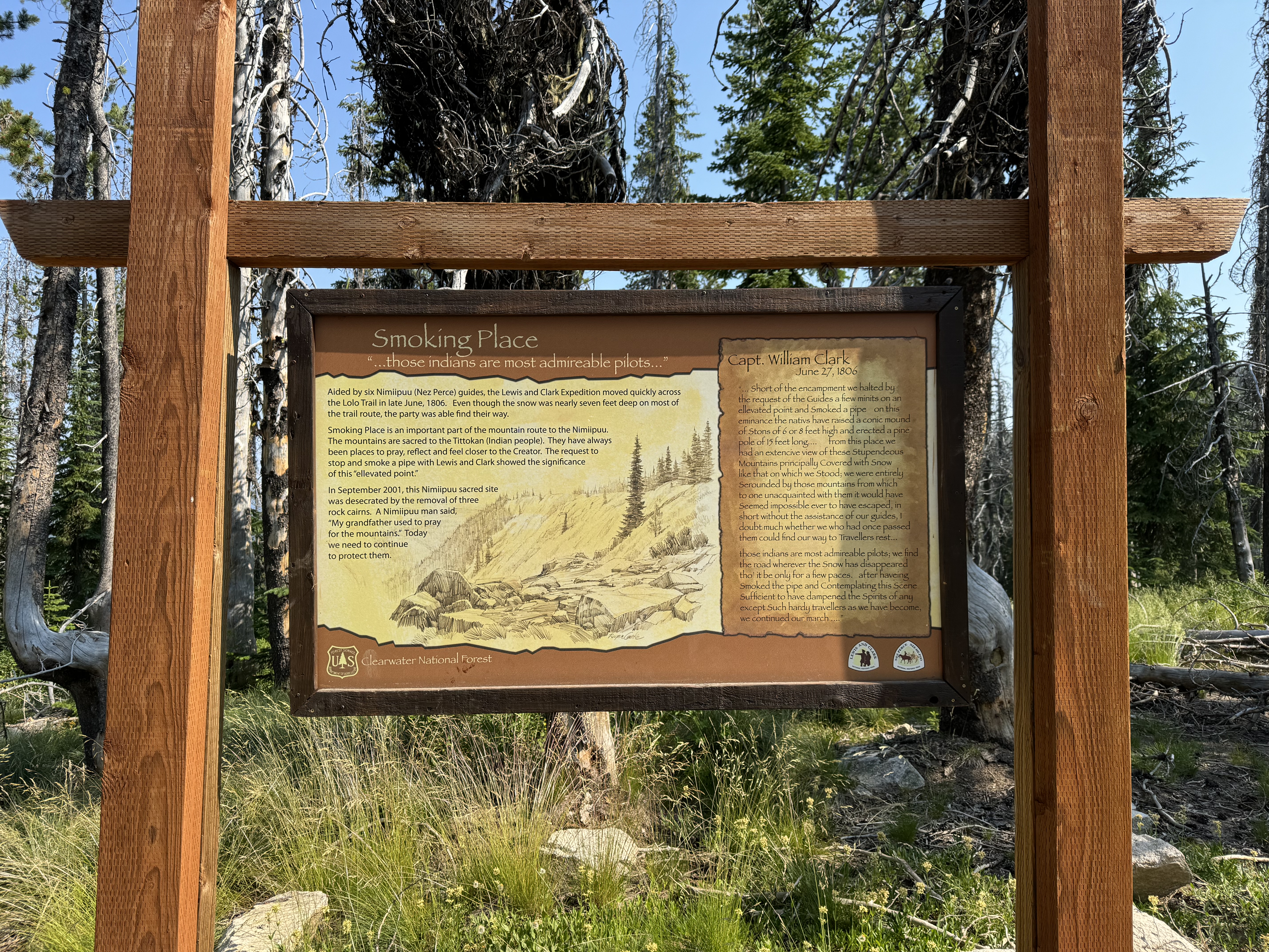
As I came closer to the end of the Magruder Corridor, there were some interesting historical markers.
There were also some interesting markers at Nez Perce Pass, the border between Montana and Idaho.
Nez Perce Pass to Darby, MT was an easy drive on paved roads. Having driven east across Idaho and into Montana, I decided that I would use the rest of the trip to return back in the other direction, making another attempt to traverse the Nez Perce Trail/Lolo Motorway. (My previous attempts had been cut short by weather and road construction). Accordingly, I headed north on US-93 through Montana's Bitterroot Valley. I stopped in Hamilton to top off my gas tank and fuel cans, continued north to the town of Lolo, then turned west on US-12 to head back into Idaho over the Lolo Pass.
For the final segment of my day's travel, I turned north off of US-12 on FR 569 (Parachute Hill Road), and finally west onto FR 500, the Lolo Trail. I drove westward on this now-familiar road, finally stopping at the historic Lewis & Clark "Snowbank Camp" for the night. This turned out to have been a 197 mile day, much of which was on unimproved gravel roads. I was ready to turn in as soon as I set up camp!
Thursday, 18 July
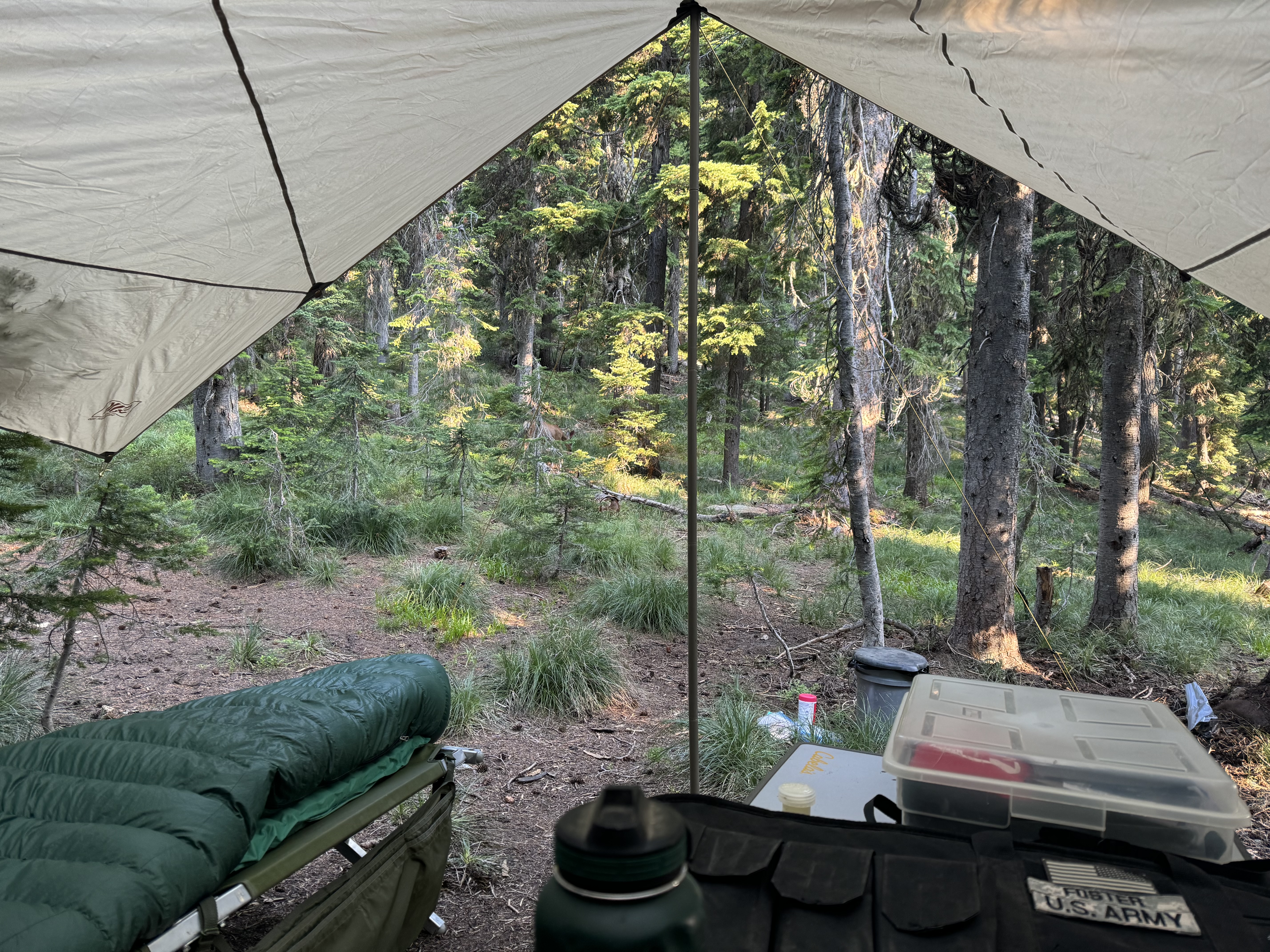
I was awakened at 0130 by the pitter-patter of raindrops on my face and sleeping bag. Since I always lay out my camp with this in mind, I was able to jump out of bed and quickly put up my Slumberjack "Roadhouse Tarp", then get back to sleep without much interruption. As it turned out, it didn't rain very hard or very long. But better safe than sorry. 🙂
 |
| Although I prefer to sleep under the open sky, a tarp will keep me dry and comfortable in most conditions when a roof is necessary. |
 |
| A curious early morning visitor. |
 |
| The site turned out to be a kind of deer crossroads, with numerous individuals and family groups passing through as I made breakfast and packed up to go. |
On my last trip down this route (cut short by road construction), I had gone exploring down a side road to see what was there, and found a really neat mountaintop that I'd thought would make a perfect campsite. I decided to head for that place, and to camp there if possible. (Translation: if I could have it to myself, lol). Because I had been over this section of the Lolo Trail before, I did not stop to read historical markers or signs, and just drove to the place I had in mind. When I got there, I was in luck - nobody else was there. So I set up camp, hoping to be able to stay for at least a couple of days.
The summer had been brutally hot so far, and there was next to no shade on this mountaintop, so I set up my tarp for shade rather than rain protection. I sited it in such a way as to be able to pull my cot out into the open to sleep under the stars. As it turned out, it never rained and the cot stayed out the whole time I was there.
 |
| July 2024 Jeep Camp 4. The pop-up green sunshade is a new addition to my gear. It was very welcome in the brutal, unrelenting heat! |
 |
| My portable shooting range. I set it up for pistol shooting at 7 yards, and spent several hours over the next couple of days practicing with different types of ammunition and different pistols. |
 |
| This was the first time I'd ever taken Bud Irish's 1935-vintage Hi-Standard Model B into the field. Teresa's mother Elaine gave me this pistol as a birthday present a few days before our wedding in 2011 "so that you can feel closer to Bud". The well-worn holster suggests that he carried it often around the farm and in the woods. It is well-made, reliable, and accurate, and was very fun and rewarding to carry and shoot. |
 |
| A period advertisement for the Hi-Standard pistol. Sure wish I could get extra magazines for $1.50! The current cost of a replacement is $75. (With inflation, $1.50 in 1935 dollars would be $34.40 today, so even without inflation, it's just plain more expensive). |
I had arrived here fairly early in the day, and so had a long afternoon and evening to relax and enjoy the surroundings. After dinner I sat and watched the sun set and the stars come out. I slept under the open sky, but for most of the night I couldn't see many stars, as the moon was so full and bright it was almost like a light was on the whole time.
Friday, 19 July
I awoke very early, and could see it was just beginning to get light. I decided to make coffee and sit in my chair and watch the sun come up. When camping, I make coffee in an old-fashioned percolator pot. It makes just enough to fill a quart thermos and a 16 oz. insulated mug. So I had plenty of coffee to just sit without moving and watch the sun rise.
I positioned myself where I thought I'd be able to see it and take nicely-framed photos with the sun in the center. I ended up with 23 photos, time-stamped from 0431 to 0531. For about 40 minutes, the sky looked essentially the same, with subtly shifting hues above the horizon to the east, as it gradually got lighter around me. My first tiny glimpse of the sun over the mountains was at 0511. For the next few minutes, the sun seemed to just leap into the sky. Due to some aspect of refraction through the atmosphere it was if I could actually see it moving. I never get tired of watching this when I am in a position to see it!
 |
| Looking east at 05:09:14 - my last photo before the sun peeked over the mountains. |
 |
| 05:11:01 - my first glimpse of the sun. |
 |
| 05:11:15 - it already seems larger. |
 |
| 05:11:43 - the sun is half-visible. |
 |
| 05:12:10 - the lower half is emerging. |
 |
| 05:12:34 - three-quarters visible. |
 |
| 05:13:12 - almost a full circle. |
 |
| 05:13:46 - like it's perched on the mountain at a tangent. |
 |
| 05:14:43 - finally clear of the mountains. |
 |
| 05:31:28 - the sun is well and truly up. Time to get out of my chair and make breakfast, lol. |
After my usual breakfast of eggs, sausage, and toast, I was puttering around camp doing something or another when I heard a noise over near my cot. I looked up to see that I had an unexpected visitor!
 |
| This mule deer buck showed up in my camp. His still-growing antlers were beautifully covered in velvet. |
A mule deer buck had decided to visit my camp, and was grazing around quite close to me. I wrote "grazing", and he was, occasionally. I had learned by observation in the Snowbank Camp that when they graze, they stamp their front hooves on the ground, making a distinctive thumping noise. I had heard the noise there without knowing what it was, until I saw one of the deer passing through paw the ground while grazing. I surmise that it somehow helps to loosen the grass or whatever ground cover they are eating. So on this morning when I heard it, I knew what it was immediately, but was surprised to look up and see the deer so close to my campsite.
I watched him for awhile, fascinated by the fact that he seemed almost completely unconcerned by my close proximity. He did stop and look up when I'd move, and shied away if I moved towards him. But I took to talking to him in a calm voice and not looking directly at him, for example: "It's ok, I'm just going over here to get a cup of water", or "It's ok, I'm just moving over to my chair", etc. It seemed to work to keep him from bounding away into the forest the way I'd expect a wild deer to act. Even the deer who live in our neighborhood in Coeur d'Alene are not this calm around us, and run off if we go outside. I took many, many photos of him throughout the day. He even came back after I'd been shooting my pistols!
As I watched him, I observed that he was not actually grazing most of the time - he was licking the beargrass, bushes, and other vegetation without actually consuming it. I was puzzled by this until it finally dawned on me what he was doing. Being in the great outdoors, miles away from anyone, is very liberating. One convenient aspect of this solitude is that when you have to pee, you can just walk a few feet away and do it wherever. (This is fine as long as you don't stay in any one place too long. More than a couple of days in one campsite, and you want to be a little more discriminating about it). But that was the key to the deer's behavior - wherever I had urinated, he went to lick the vegetation, presumably to get the salt. Once I realized this, I confirmed it by wandering a little farther afield when I had the urge to go. Sure enough, shortly afterwards my new friend would show up and begin licking the vegetation on that spot! He hung around my camp all day long and even into the night and the next morning. It was quite a unique experience to have him around so close to me for such an extended period.
 |
| Once I realized what he was doing, I had an unusual feeling of connection with this wild creature. |
 |
| In truth, I was the visitor here. This magnificent mountaintop setting is actually his home, which I was privileged to share with him for a couple of days. |
 |
| My simple little shooting range. The targets are paper plates with a 3/4" black sticker for an aiming point. To the right are steel "spinners". The smaller one with three different sizes is for .22LR, and the single, heavier one is for larger calibers. I mostly shot .22LR pistols (a Ruger SP101 revolver and the Hi-Standard Model B), but I also practiced with my Kimber Camp Guard 10mm. |
This mountaintop was once the site of a USFS fire lookout tower. Nothing remains of it but some concrete blocks that formed the bases for the legs, and some random pieces of steel here and there. But before I left, I did notice something interesting - a row of rocks that seemed unnaturally symmetrical. I followed it into the woods by my campsite, and it became apparent that it was actually two rows of rocks, arranged as the border of a path leading off to a secluded little enclave behind the large standing rock formation near my campsite. It had obviously been there a long time, as there were some fairly mature trees growing right in the middle of the (former) path. As I followed it to its terminus in the shaded little glen, it was easy to imagine a Forest Service Ranger living alone up here for the summer, spending time making a path to a private retreat away from the lookout tower. It also put me in mind of Dagny Taggart building the path during her month-long sojourn at the cabin after leaving Taggart Transcontinental.
 |
| Walking through the woods a little ways from my campsite, I came across these rocks. They had clearly been arranged by human hands. |
 |
| Curious, I followed the now-overgrown path. |
 |
| At its end, the path curved off into a little shaded enclave in the rocks. |
As beautiful as the mountaintop campsite was, it was also very hot, with only intermittent breezes and no respite from the intense heat except for my little sunshade and tarp. So I decided to move on the next day.
Saturday, 20 July
I awoke at 0430, and immediately got up to make breakfast and break camp. The buck was still there, having hung around all night. He finally disappeared once I started breaking down and packing up. I was completely packed and ready to go by about 0800, and started off on my day's drive. Today I planned to continue to follow the Lolo Trail/Lolo Motorway. Once I reached the section that had been closed for repairs during my last attempt, I began to stop to read and photograph the historical markers along the route. I include the photos of these markers below, as self-explanatory without additional comment.


It was a long, hot, dusty drive, alternating between burned areas and lush, unburned forest. A couple of times, I stopped in these still-green sections to get a refreshing drink of cold water from a roadside spring using my venerable Sierra Club cup. I am also not ashamed to admit that I was grateful for my air conditioning. I kept it on even when driving with the windows open. The heat wave we had been experiencing was pretty extreme, and there were no chilly nights to provide relief - I think the lowest temperature I experienced on the entire trip was an overnight low of 57°F.
I finally came to the end of the Lolo Motorway, and had to decide where to go for the rest of my planned time. Since I'd already made a grand sweep east, then circled around to the north and back west, I decided to complete a sort of "S" shaped path, following historic gold-rush routes back up through the Clearwater National Forest, from where I would eventually find my way home.
Accordingly, I made my way back to US-12 and the town of Kamiah on the Nez Perce Reservation. There I stopped to refill both gas and ice. Normally my
Idaho-made Cordova cooler does an amazing job of keeping ice frozen for well over a week (It's by far the best cooler I have ever owned). But the extreme heat had taken its toll, and I needed a couple of additional bags to make sure my remaining fresh food stayed that way.
From Kamiah, I headed north, then east on Idaho 11 along the
Gold Rush Historic Byway through Weippe (pronounced "Wee-ipe"), and then to the town of Pierce. I stopped in Pierce to grab something to tide me over until supper, and selected an apple and a Snickers bar, both of which were delicious treats and out of the ordinary for my camping trips. From Pierce I turned off the main road and followed FR 250 northeast. This seemed to be a likely route through the Clearwater NF, promising good scenery and an eventual route home. I started looking for a place to stop for the night, and soon found a likely-looking turnout that led to a nice little level clearing. The road was blocked shortly after the clearing with a locked gate that had a sign saying "Restricted Use Area", so I was pretty confident that this was a place where I'd be out of the way and could spend a peaceful night.
While setting up my campsite, I heard a vehicle approaching down the little side road, and saw it stop in front of the gate. The road was obscured by some bushes so I couldn't see it, but I assumed it was a US Forest Service vehicle, as I could tell they were getting out to open the gate. I went back to setting up camp. Soon I heard a voice say "What's going on?". "Just stopping for the night", I said. Two interesting looking characters emerged from behind the bushes, and I was pretty sure they were *not* USFS employees. They were in well-worn work clothes, and one of them had no front teeth and was carrying a Ruger Blackhawk revolver. (I told a friend about them later, and he said it sounded like something from "Deliverance". Although I hadn't thought of the comparison at the time, it wasn't too far off, lol).
They started asking me questions, and soon I asked them whether I was on private property by mistake. I told them I'd been pretty sure it was Forest Service land, but that if I'd made a mistake and was on their place I'd be happy to leave. It turned out that although I was on USFS land, it was also their mining claim. So while it is still technically public property, they have certain rights to it, and others are constrained from interfering with those rights. They told me they had a sign posted with their claim in a jar nailed to a tree, but I told them I hadn't seen it (I went to look at it later on after we'd talked).
 |
| The sign I had missed on the way in to my campsite. |
Talking with Dan and Bob the gold miners was actually pretty interesting - I assured them that I was not going to mess with their stuff, as I thought they were mainly worried about theft. But it turned out that in addition to claim jumpers, they also have to deal with sabotage by environmental activists who oppose mining. Dan did most of the talking, while Bob sort of hung back watching me. They quizzed me about my politics: "Are you an environmentalist?" "No, but I am a conservationist - I enjoy wilderness but I believe in multiple-use resource management". They asked some questions about my attitude toward mining, logging, etc. (I support them, as necessary for industry). I gave them my North Idaho Objectivism Society business card, and they liked both the "COL, U.S. Army (Retired)" and the byline of "Reason, Individualism, Capitalism". "Are you a Republican or a Democrat?" That one made me laugh out loud - not only was I openly carrying a pistol, I was also wearing a t-shirt with a red, white, and blue representation of the state of Idaho composed of the outlines of guns. I pointed to the shirt and laughingly asked "Do I look like a f***ing Democrat to you?" I think that finally convinced them that I was one of the good guys, lol.
 |
| Hmm - can you guess my politics? |
They told me a little about their mine - it's a hard rock claim, with a 100 foot vertical shaft leading down to a 250 foot horizontal shaft following a gold vein. Dan told me about a rock he'd recently dug up that split open to reveal pure gold inside. It sounded just like the one in the movie "Pale Rider". After we'd talked awhile, they said it was fine if I stayed there, and they went about their business. I finished setting up camp and had dinner. They drove out and closed the gate a couple of hours later, and we waved as they departed for the night.
Sunday, 21 July
The next morning Dan and Bob drove up as I was breaking camp, and stopped to talk again as they opened the gate to go to work. I jokingly told them that some claim jumpers had come by in the night, but that I'd run them off. Bob said: “Good. I hate shootin' people, ‘cause then I have to bury 'em”. Just another day in North Idaho, lol. 😂
I spent the day driving on FR 250 eastwards. This turned out to be a very beautiful and popular route, largely following the path of the Clearwater River. I passed a number of USFS roadside campgrounds, many of them occupied, including what looked like some large family groups of several tents, trailers, and RV's. My practice whenever I approach an occupied campsite is to immediately slow down to a crawl to minimize the dust. But this was not the practice of most of the vehicles that passed me going in the opposite direction. As it was Sunday, many people were packing up and heading for home, which meant westward out of the mountains. I felt bad for the people sitting in their campsites getting covered by the clouds of dust raised by these yo-yos as they barreled along the gravel road at relatively high speeds. More than one person waved and said "thank you" to me as I passed their campsites at 3-5 mph.
 |
| The Clearwater River. Most of the really beautiful spots had people camping, swimming, or fishing, so I didn't take photos. It's the main reason I usually avoid traveling on weekends. |
Studying the map looking for the best way to eventually get out of the mountains to head home, I saw a likely - looking route that turned off of FR 250 at a place called "The Cedars". It looked like I could take FR 720 west and north to get out of the Clearwater and over a pass into the St. Joe National Forest, and from there back to paved roads and home. There was no rush, as I still had a couple of days before I planned to leave, and it looked like there was plenty of promising country along the way.
By the time I reached the turnoff to FR 720, I was ready to stop any time. A short distance up the road, I turned onto a side road that seemed like it would lead down to the river. Sure enough, it led down to a nice little clearing right next to the river, and I decided that was where I would spend the night. I don't remember exactly how long it took me, but it was probably at least 10 or 15 minutes before I realized that I knew this place - it was exactly the same place I had camped on another trip, two years earlier! I had not recognized it at first because I had approached it from the opposite direction. Now I realized that my proposed route heading back towards home was the same route I had taken into the mountains on that trip (there are only so many passes, after all). I was thus able to visualize the drive I had ahead of me (beautiful but rugged). So I settled in to set up camp. I think this might have been the first time since coming to Idaho that I have ever camped in the same place a second time, and it turns out to have been a complete accident.
 |
| "July 2024 Jeep Camp 6". I was grateful to have the sunshade with me this time, as it was very hot. |
There was still a lot of daylight left, so I was able to set up camp and relax. It was quite warm, but the river provided some relief. I decided I'd spend the next day here shooting. It was ideally situated for me to set up an impromptu rifle range out to 125 yards oriented back up the road leading down to the river. The access road went past right above me and then through a hairpin bend back toward the campsite, so I'd hear anyone approaching long before they were anywhere near "downrange". I put the warning triangle from my Jeep just before the turn as a safety measure just in case. In the event, nobody came down after I'd set it up. But better safe than sorry.
I spent a part of the evening taking a very refreshing bath, followed by clean clothes. I also did a thorough damp-cloth wipedown of the interior of the Jeep. It's amazing how much dust accumulates when you're traveling on these dirt roads. I sat up very late into the evening, finally turning in sometime after midnight.
Monday 22 July
I awoke at 0500, but dozed lazily until 0600 when I finally got up and made breakfast. I had a "make and mend" morning, doing a little sewing and making some minor repairs and improvements to my outfit. I also decided this would be a good day to have my second steak (for lunch, this time) and then to use the already-warm dutch oven to bake a peach cobbler and some "johnny cake", a.k.a. corn bread (actually just Jiffy mix, but don't tell my BSA cooking merit badge counselor).
 |
| Dutch oven dump cake, a.k.a. "Lazy Cobbler": Pour in a can of peaches, dump the cake mix on top, add a few pads of butter, sprinkle some cinnamon on top, wait 40 minutes, and voila! |
 |
| I never get tired of this treat. I always think I'll save some for the next day, but then suddenly the pan is empty... |
 |
| "Johnny cake" - great with butter, and even better with a little honey. |
I actually have a dutch oven cookbook with some great recipes, but it's so easy to use the prepared mixes that I rarely bother. One of these days...
After lunch, I set up my targets to begin an afternoon of shooting. My objective this time was to shoot my Tippmann M4-22 rifle to establish the sight settings for various distances, in preparation for an Appleseed event later this year. I already had the 25-yard zero, and wanted to find the come-ups for 50, 75, 100, and 125 yards. Once everything was ready, I settled in for a pleasant afternoon. But on the third round, I experienced a malfunction, very similar to the malfunction for which I'd sent the rifle back to the manufacturer earlier in the year. I was not a happy camper.
 |
| The .22LR round failed at the rim, blowing out the extractor. Fortunately the bullet exited the barrel, but suddenly I had a single-shot rifle. |
 |
| The apparent culprit - Remington HV "Golden Bullet" ammo. I have never had it fail in any other rifle but this one. |
Back in May I had experienced an out-of-battery detonation using the same rifle and ammunition, and had sent the rifle back to the manufacturer. There was some question as to whether the ammunition was to blame, but I have shot thousands of rounds of the same ammo through a number of different guns with no problem, so I didn't think so. They eventually diagnosed the cause as an out-of-spec bolt and firing pin (it was a very early Generation 1 rifle that somehow slipped through QC). They replaced the barrel and bolt group and sent it back to me. My intent this time around was to test it with a variety of ammo to see what worked best. Unfortunately, I started off using the same ammunition as before, and experienced this result.
Subsequently I found that a number of other Project Appleseed instructors have experienced similar problems with Remington ammunition. So despite my long track record of shooting it with no problems, it is apparently incompatible with this rifle, at least. (Aside - when I returned home, I contacted the manufacturer and they sent me two new sets of extractor parts, one for repair and one for a spare. They acknowledged a design problem with the extractor that they are trying to solve, but there still appears to be an issue with the ammunition so I am switching brands. My future shooting with this rifle will be with CCI Mini-Mag .22LR. It has a great reputation and has functioned flawlessly in my post-trip shooting). But back to the campsite in the mountains - my shooting was ended for the day.
It was about 3:30 PM, very hot and dry, my plans for the afternoon had been frustrated, and my attitude was consequently somewhat less enthusiastic than it had been. Additionally, I had a lot to prepare for later in the week. It didn't take me long to decide that there was no real reason to stay there another night, so I packed up and left for home, getting on the road by 1730.
The long summer daylight hours made for a beautiful drive out of the Clearwater Mountains and up over the pass into the St Joe National Forest. I had one slightly distressing experience on my way out of the mountains, however. As I rounded a curve in the road, I surprised a doe and two fawns who were walking down the road in the same direction I was traveling. Their response to the appearance of my Jeep was to run ahead on the road. I was not going fast, and even slowed down a bit, but they just kept running on ahead, and didn't run off to the side into the woods up or down the mountain. Eventually the doe and one fawn did bolt off into the woods, but the other fawn did not see them do it, and kept running down the road ahead of me. I slowed down and stopped, hoping it would go back around me, but it was too scared of the Jeep to do that. Every time I'd start up and crawl down the road a bit, it would just keep running down the road in front, rather than going into the woods on either side to hide. I couldn't just wait there all night, as I had a long drive home. I finally decided that I'd stop and turn off the Jeep completely, and see if maybe then it would double back. But just as I decided to do that, it finally ran off into the woods and hid, so I kept on driving by. I hoped that it would be able to find its way back to its mother.
It took me longer to get over the pass and back to the paved highway than I had expected, but by this time I was not interested in unpacking everything again to set up camp, so I just kept driving. I arrived home in Coeur d'Alene at 0315 on Tuesday morning, took a shower and went right to sleep. It was a slightly anticlimactic ending to what had been a very rewarding and interesting trip, but I was OK with it, as it gave me some much-needed additional time to prepare for the eventful week ahead. (One reason it took so long to write this entry was that I have been busy non-stop since then).
Mood: Happy (to finally have written this!)
Music: Silence