Idaho Centennial Trail Part Ib - Hiking in the Desert
After a frenetic month of April during which I planned and prepared to hike the desert section of the Idaho Centennial Trail (ICT) in addition to planning and executing a philosophic discussion session and our annual Project Appleseed Patriots Day shoot, it was finally time to head for the trailhead and start my first ICT section hike. It turned out to be quite an adventure, although *not* the kind of adventure I had planned. Instead, it turned out to be a cautionary tale.
Tuesday, 30 April
I awoke at 0400 and was on the road by 0500 for the eight-to-nine hour drive from our home in Coeur d'Alene to Hammett, Idaho where I would park my Jeep and meet Dennis, the "trail angel" who would drive me to the trailhead. Much of the drive has become familiar to me by now. In order to get to most of the wilderness areas in Idaho I have to either take I-90 east into Montana and then head south down US-93 back into Idaho, or else drive south on US-95 until I can cut over west into whichever area is my destination. In this case I was driving all the way south to I-84 in Boise, then east through Mountain Home to the tiny town of Hammett.
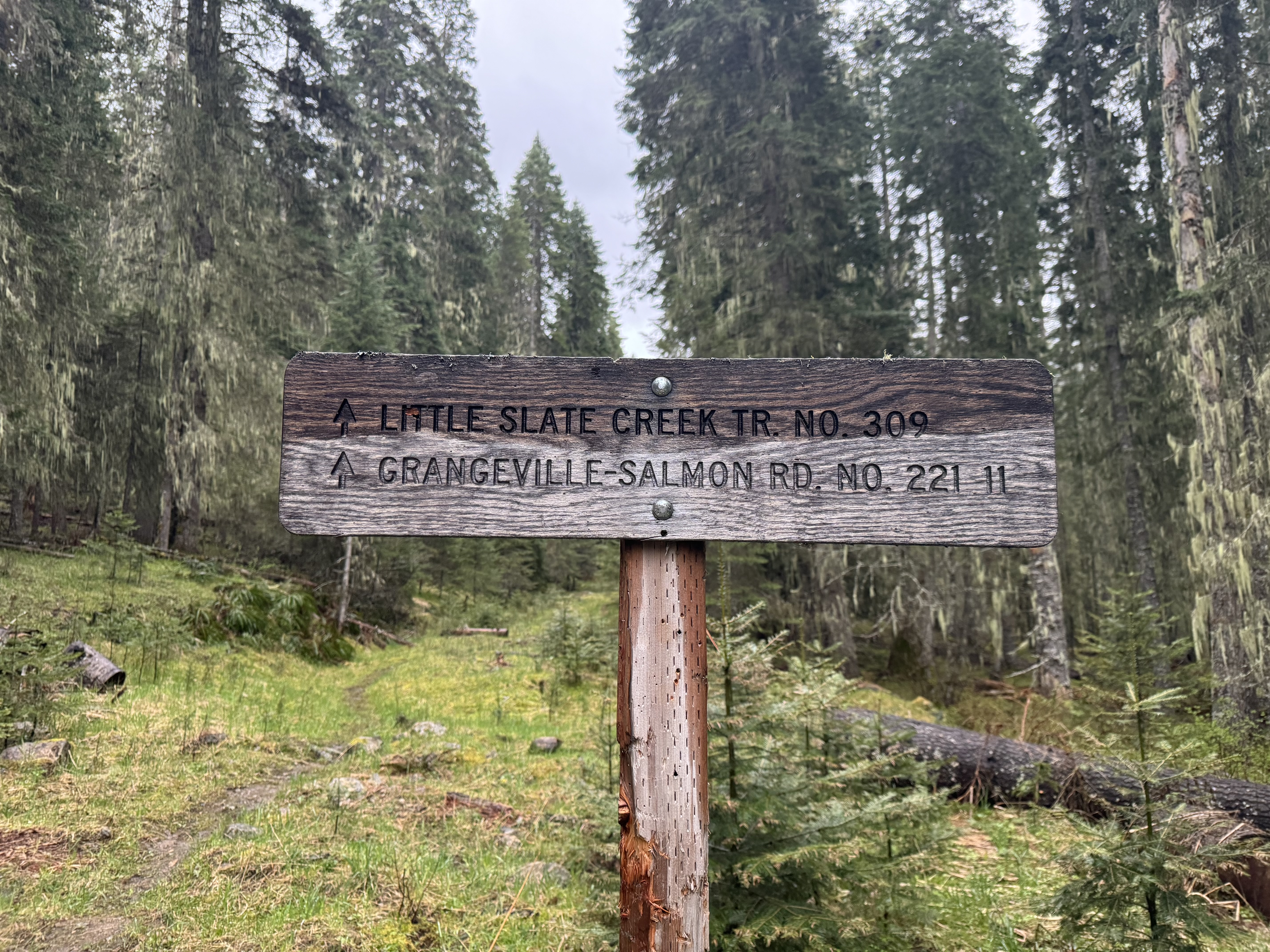
I passed many familiar landmarks as I drove through the small towns and countryside of the Coeur d'Alene and Nez Perce Indian reservations, including the soon-to-close lumber mill in Plummer. As I came out of the mountains and onto the Camas Prairie just northwest of Grangeville, I was not surprised to run into snow (~ 3800 feet). Welcome to Springtime in Idaho!
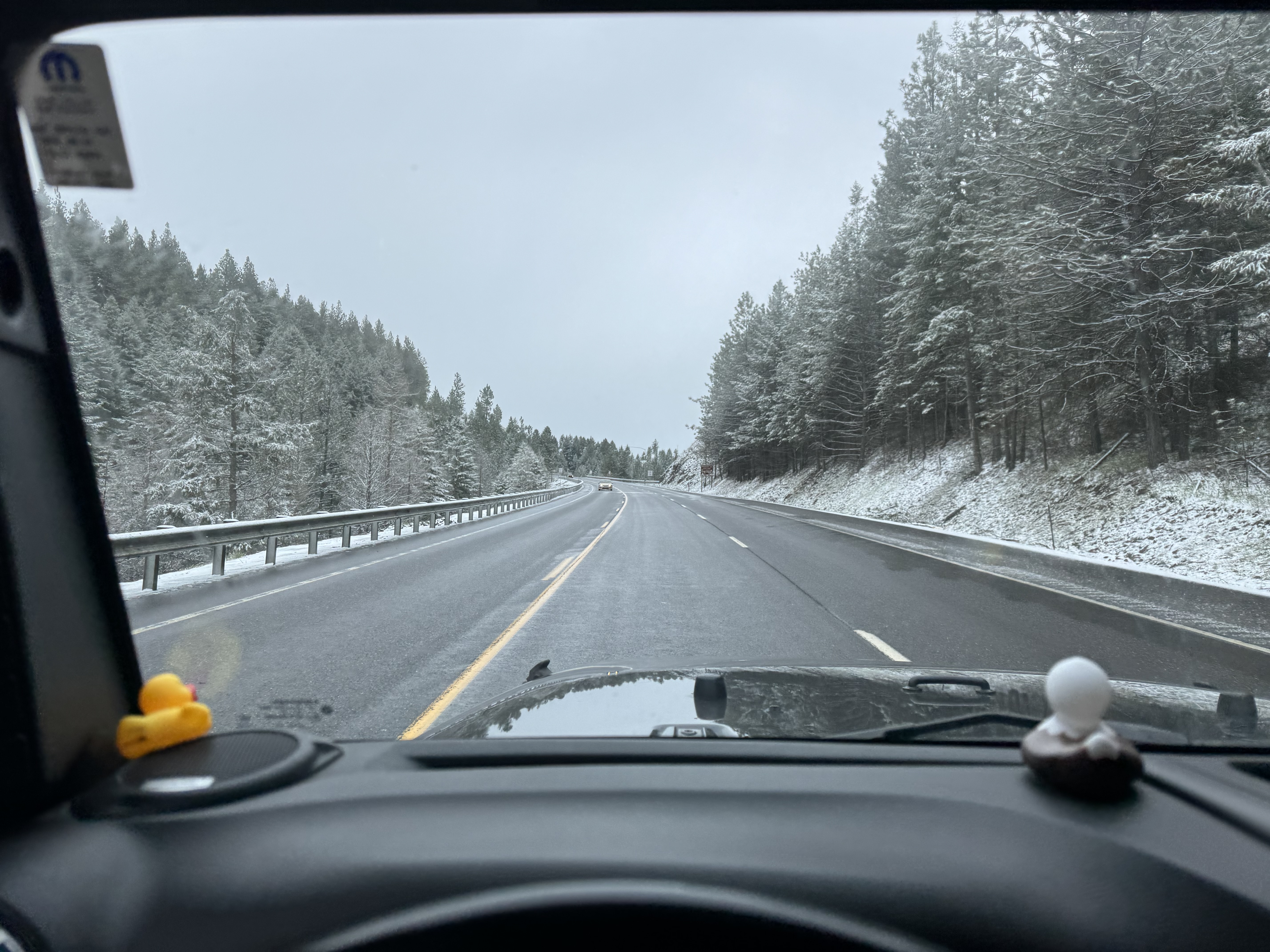

After stopping for gas in Grangeville, I went over the White Bird Hill Summit, a pass which separates the Camas Prairie from the Salmon River drainage. Coming over this pass southbound is one of my favorite parts of the drive. The views are dramatic as you descend to the Salmon River- photos just can't do it justice. There wasn't even a road over the pass until 1921.
 |
| Historical marker on White Bird Hill Summit |
 |
| Descending toward the Salmon River on US-95 south of White Bird Hill. |
Most of the drive so far had either been in silence or else accompanied by music through Sirius XM (notably the stations Classic Vinyl, Classic Rewind, and Ozzy's Boneyard, with occasional stints of Turbo, Octane, and Liquid Metal). But coming over the pass I was moved to put on Tom Petty's "Highway Companion" album, followed by "Full Moon Fever". The tempo and lyrics of several of the songs really fit my upbeat, happy mood as I anticipated the next few days of adventure:
Saving Grace ("You keep runnin' for another place, to find that saving grace.")
Flirtin' with Time ("This could well be your last stand, hold the sunlight in your hand.")
Big Weekend ("Kick up the dust...if you don't run, you rust.")
I Won't Back Down ("Well I know what's right, I've got just one life.")
Love is a Long Road ("...but love is a long, long road.")
Runnin' Down a Dream ("It was a beautiful day...I had the radio on, I was drivin'...")
I usually stop on my way south at Jimmy John's in Moscow and buy a "Gargantuan" sandwich, half of which serves as lunch on the drive and the other half as dinner on my first night outdoors. Today I passed through Moscow too early for that, so I stopped at the market in Riggins to buy something for lunch. Riggins is a tiny little town along the Salmon River whose main business is tourism. The majoritiy of businesses seem to be bars and restaurants, hotels, campgrounds, and rafting operations. I was delighted to learn that the market has a deli. The two excellent roast-beef-and-provolone sandwiches on wheat buns that I bought there confirmed this as my new regular lunch/dinner stop on these drives.

The rest of my drive passed uneventfully, except for a misstep in Boise when I decided to defy my GPS and take a route to I-84 that the map showed was obviously shorter than the way the GPS was steering me. Wrong answer! It took me at least 20-25 minutes to go six miles, at 1430 on a Tuesday. I called Teresa to tell her that I was car number 15 waiting in one of two left-turn lanes on an eight-lane surface street, looking out my window into one of the subdivisions where we had actually considered buying a house. We made a great decision to move to Coeur d'Alene!
I met Dennis at the Cold Springs Winery in Hammett. I had intended to park my car at the Bureau of Land Management (BLM) guard station, but winery owners Bud and Jennifer were kind enough to let me park my Jeep on their property, which made me feel much better. They are really nice people, and their wine is excellent - I highly recommend it if you are in the area:
Cold Springs Winery (Website still under construction)
Dennis and I got to know each other a bit on the two-hour drive from the winery to the trailhead on the Nevada border. He is a soon-to-be-retired Army Colonel who owns a ranch in Fairfield. He is active in supporting the development and maintenance of non-motorized trails, which is one reason he volunteers as a "trail angel", helping hikers through this portion of the ICT by driving, resupply, or a stay at his BNB for a respite from the trail. Another of his retirement projects is raising Highland Cattle. He will ship the the high-quality USDA-processed beef directly to your door:
Soldier Mountain Highlands & Huns Ranch (Website still under construction)
When Dennis dropped me off at the trailhead, we shook hands and took a couple of photos:
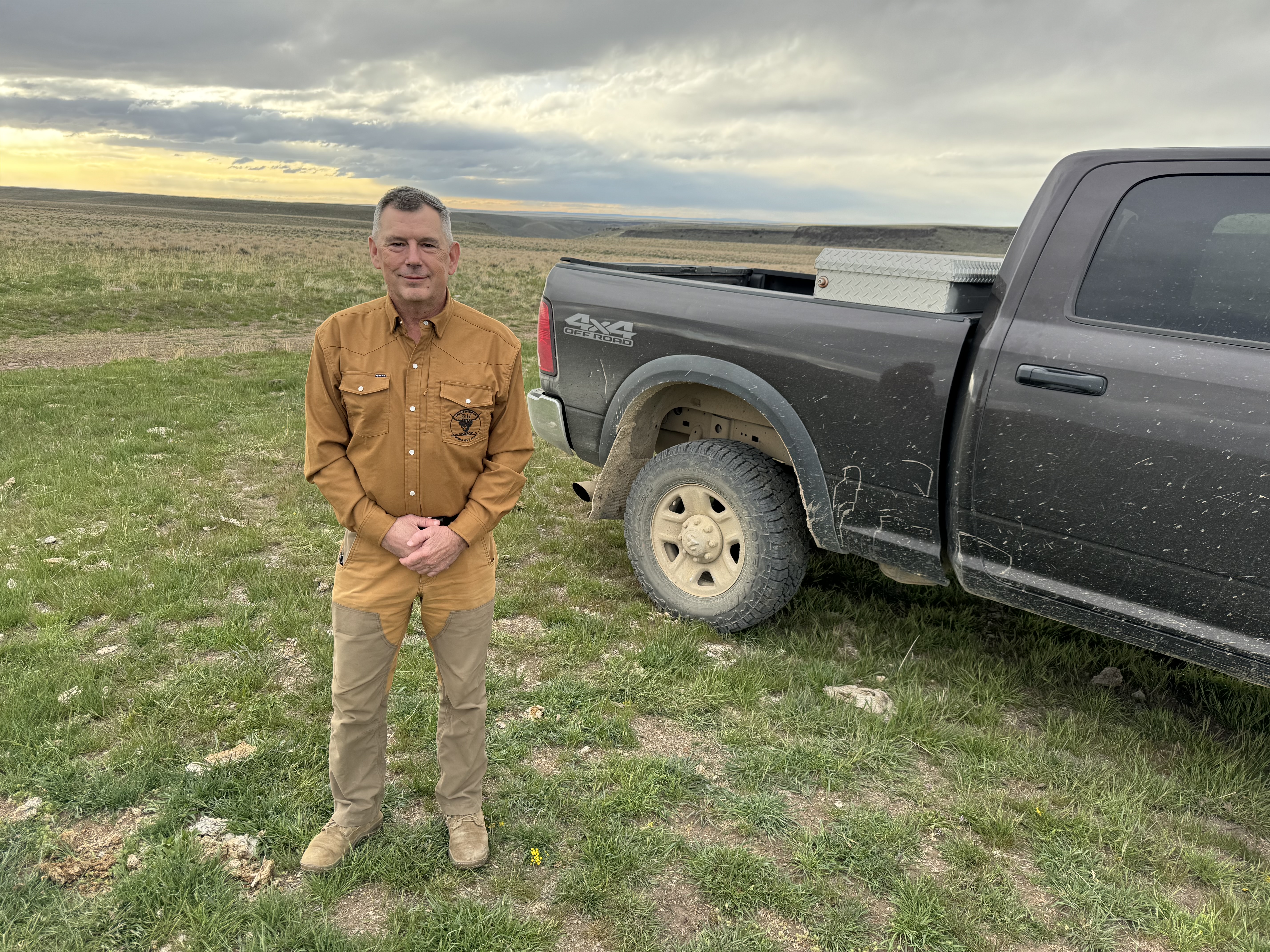 |
| "Trail Angel" Dennis |
 |
| Standing at the ICT trailhead, on the Idaho side. The orange post is in Nevada. |
 |
| Dennis drove off to return to his ranch, and I was on my own. My route in the morning would start off by heading north to the top of the butte visible in the distance past his truck. |
Since the weather was threatening (windy and cold, and looked like rain), my first job was to pick a spot to pitch my shelter. For this trip I had purchased an Owyhee Tarp from Six Moon Designs. This is an ultralight tarp made from Silnylon that has some very innovative features that place it head and shoulders above my traditional 7'x9' rectangular ripstop nylon tarp. From the outside, it looks for all the world like a tent, because it has a zippered vestibule on either side of the sleeping area. It came with a separate groundsheet that fastens into the corners to keep it from slipping around. Its most unusual feature is that it has a skirt of mosquito netting all around the bottom, so that when the vestibules are zipped shut, the netting keeps flying insects outside. I had originally intended to use it with my trekking poles, but when it arrived I quickly realized that my poles are not compatible with it. As I do not trust collapsible poles, I have Black Diamond Carbon-Z trekking poles. These are not collapsible and are thus too long to use as poles for the tarp. I ended up buying a set of collapsible carbon-fiber poles from Six Moon Designs that are extremely light, and purpose-designed for the tarp. Closer and closer to a tent (except for the weight!)
 |
| The Owyhee tarp, looking NW as the sun sets. |
When I got up in the middle of the night, the wind had calmed down and the stars were out. I didn't have the energy to take the tarp down partway so I could see them from my sleeping bag, but I planned to do that later on in the trip. That has always been my practice when tarp camping: sleep under the stars whenever possible, and when the weather is threatening rain, set the tarp up and then take it partway down by disconnecting one side. If the rain starts while you're sleeping, it's a simple matter to jump up and hook the guylines over the pre-positioned stakes for instant shelter.
I finally got to bed at 2130 for a much-needed night's rest. The next day would officially be "Day 1" of my ICT section hike through the desert.
Wednesday 1 May
I awakened at 0500 after an excellent night's sleep. Last year I had switched to the Haven Hammock as my backpacking shelter, but because that was impractical here and I'd be sleeping on the ground again, I had decided to upgrade my sleeping pad from the Thermarest Classic that I've used for the last 20-30 years or so. I ended up with a Thermarest TrailPro. These come in several sizes, and I had chosen the smallest one ("Regular") to save weight and bulk. It was perfectly adequate in terms of size, and superb in terms of comfort! When inflated it is at least twice as thick as the Thermarest Classic. Nonetheless it weighs less than the full-length Classic and only slightly more than the hip-length version that I used before.
When I bought the new pad, I had been surprised to find that it did not include a repair kit like the older ones had. A call to the company revealed that it was supposed to have had one included. I surmise that someone probably just stole it while it was on the shelf at REI in Spokane. The customer support rep told me he'd send me a couple repair kits, but then recommended a completely different approach. He said that their tech support department has gone to using Aquaseal UV for all their repairs. According to him, it is amazing stuff. You put a tiny amount on while in the shade, and then expose it to sunlight for a few seconds to cure it. They use it for tents, air mattresses, and everything else. So I bought a tube of that and added it to my repair kit.
I had also been disappointed to see that the updated Thermarest Trekker chair that they make for this new pad is bright orange in color. I HATE brightly-colored outdoor gear, and I consider it rude and inconsiderate to use it in the wilderness. People go into the wilderness to be alone with nature, and few things spoil that feeling of solitude more completely than the sight of a brightly-colored tent, pack, jacket, or other gear off in the distance someplace. I tried really hard to convince myself that it wasn't that bad, and that nobody would see the chair but me. But I just couldn't do it. So I took along the chair from my Thermarest Classic. It was not optimally shaped, but it worked, and it is a nice healthy forest green in color.
Back to the morning: I made my traditional morning hot drinks: one cup of spice tea and a second cup of instant coffee. (These are actually 16-oz "cups"). I found that the new solid-fuel stove I had bought worked very well. I had determined to switch from a cannister stove to a solid-fuel ("Esbit") stove for this trip in order to save weight. The traditional Esbit stove is a bit heavy itself, and doesn't really provide much wind resistance, so I looked for an alternative and found the Expedition Research solid fuel titanium stove. It is very light, packs flat, assembles in seconds, and has pretty good wind protection. Because I knew how windy it had been on my earlier trip to the desert, I also brought along my old aluminum folding windscreen that I had used with the Svea 123 stove of my youth. Aside from my OR low-top gaiters that need replacing, I believe this windscreen is the very last item from my original 1970s backpacking outfit to remain in service. Together they made quite an efficient stove. I found that half of an Esbit fuel tab was enough to adequately heat a 16-oz drink, and that a full fuel tab would vigorously boil the 11-14 oz. of water called for to reconstitute the various Mountain House meals I had for dinner.
The rest of my breakfast consists of a pre-mixed bag of dried milk, protein powder, and fiber powder, which I dump into a one-pint Nalgene bottle and shake up with 8 oz of water. Once this is mixed, I dump in one cup of Quaker Oats Simply Granola, shake it up, and wait for it to soften a bit while I pack up and prepare to get going for the day. Once the granola has soaked for awhile, it is much easier to chew and I can drink the resulting slurry with some occasional help from a spoon. It's a fast way to get started on the day without too much fooling around.
I had slept in a Smartwool 150 long underwear top and bottoms. As it was still very cold when I woke up (30º F), I decided to start off walking still wearing the top, but not the bottoms as it would be too much trouble to remove them as it got warmer. In cutting back to save weight, I had decided to leave my Eddie Bauer down shirt behind and just rely on my trusty old down vest for warmth when needed. While breaking camp and packing up, a long-sleeve Columbia shirt, down vest, fleece watch cap, and lightweight Gore-Tex rain /wind jacket kept me warm. I also had polypro wristovers and a pair of Outdoor Research lightweight gloves. I was glad to have both as the wind very quickly sucked the heat out of any exposed parts.
I had taken no particular precautions with my water, and I found that the bite valve on my Camelbak had frozen overnight. It caused no problem as the water in the reservoir was cold but not frozen. I suspect that had there been water in the tube it would have frozen as well, so I was glad to have developed the habit of always blowing out the tube on my Camelbak to keep the water in the reservoir. Originally this had been to keep it from getting warm in the sun, but it works equally well to keep it from freezing.
 |
| All saddled up and ready to step into Idaho and onto the ICT! |
 |
| The view looking south from the trailhead with the Jarbidge Mountains in the distance. |
I took off the down vest but left the rest on, and started off at 0930 with tracking running on both the Garmin Messenger and also on OnX Backcountry on my iPhone. The two tracks serve different purposes - the Garmin for remote tracking and the OnX so that I can watch my own progress on the map, including how far I've traveled in each segment. Later on I would decide to stop tracking on the OnX map, which dramatically reduced the power consumption on the iPhone. But at this point I was still using both and watching how they affected the batteries.
It didn't take long for me to fall into my old familiar walking routine - 45 minutes of walking followed by a 15-minute rest stop. I modify this as dictated by terrain - a convenient place to sit or a nice view can cause me to stop early or go on a bit further. But I am pretty regular in this regard, which has always enabled me to keep going, hour after hour, without feeling excessively tired. The first hour was a nice easy walk to the north, with a convenient large rock located right at the top of the butte, and reached 1.22 miles and almost exactly 45 minutes after I'd started walking. This was consistent with my normal walking pace of about 2 mph when carrying a backpack. I am *not* a speed-hiker. I prefer to just sort of amble along, enjoying the walk and noticing details along the way.
 |
| My first rest stop. Looking west, you can just see the beginnings of the Jarbidge River canyon where the road leads down to Murphy Hot Springs. |
My first rest stop was at the top of the butte visible from the trailhead, 5694 ft. elevation. The wind was cold, strong, and relentless, and my fingers grew numb without gloves on. But the sunlight felt good and it was a beautiful day. The official ICT goes through the desert above the Jarbidge River Canyon, but in their 2023 book on the ICT, Lisa and Jeremy Johnson recommended taking the first leg through the canyon to enjoy the river before climbing back up into the desert, and I intended to follow their advice. After 15 minutes I got up to continue the short distance down the trail to the road, and to begin the descent into the Jarbidge River Canyon.
 |
| Looking northeast where Three Creek Road intersects with the ICT. The white ICT trail markers are visible for long distances in the desert. |
 |
| Looking southwest down the road toward Murphy Hot Springs in the Jarbidge River Canyon. |
The road was an improved gravel road, so walking was easy, albeit a steady, fairly steep downhill, which can be hard on the feet. At 1115 I stopped for a rest and decided it was time for lunch. I climbed up above the road and found a place to sit down, and enjoyed a Vanilla Chai flavored RecPak, my no-fuss lunch choice for backpacking.
 |
| Looking south from the road into the canyon. I'd have loved to see them stringing the power lines! |
 |
| The road just kept going down, and down, and down... |
 |
| Partway down I noticed this obviously man-made stone wall going up and down the sides of the canyon on both sides of the road, and wondered how long it had been there. |
 |
| I couldn't see a purpose for the stone wall, unless it predates the existence of the improved gravel road. In that case it could have been to keep domesticated animals from wandering out of the canyon. |
I stopped to rest again at the bottom of the road, partway into Murphy Hot Springs. I don't know if it's officially a town or what exactly, but it is an enclave of private property with an eclectic collection of houses, outbuildings, trailers, campers, and lots of miscellaneous junk like you might see on an old farmstead or ranch. At least part of the place seems intended to attract tourists, as there are some picnic tables and a couple of places that looked like motels or rental cabins. I was happy to take advantage of one of the picnic tables for my brief respite, as my quads were feeling the long descent down the hill.
 |
| A rare commodity in the desert - a place to sit. |
 |
| An interesting building, but I don't know the nature of their business. |
 |
| I puzzled over this "rifle", but it doesn't resemble anything with which I am familiar. The butt stock looks like it came off of a US M1917 or a British P14 Enfield, but it's cut off at the wrist. I thought the barreled action might be from a Krag-Jorgensen, but it's not. I think it's just something that somebody cobbled together from random parts and junk to make a rifle-looking thing to hang on the wall. |
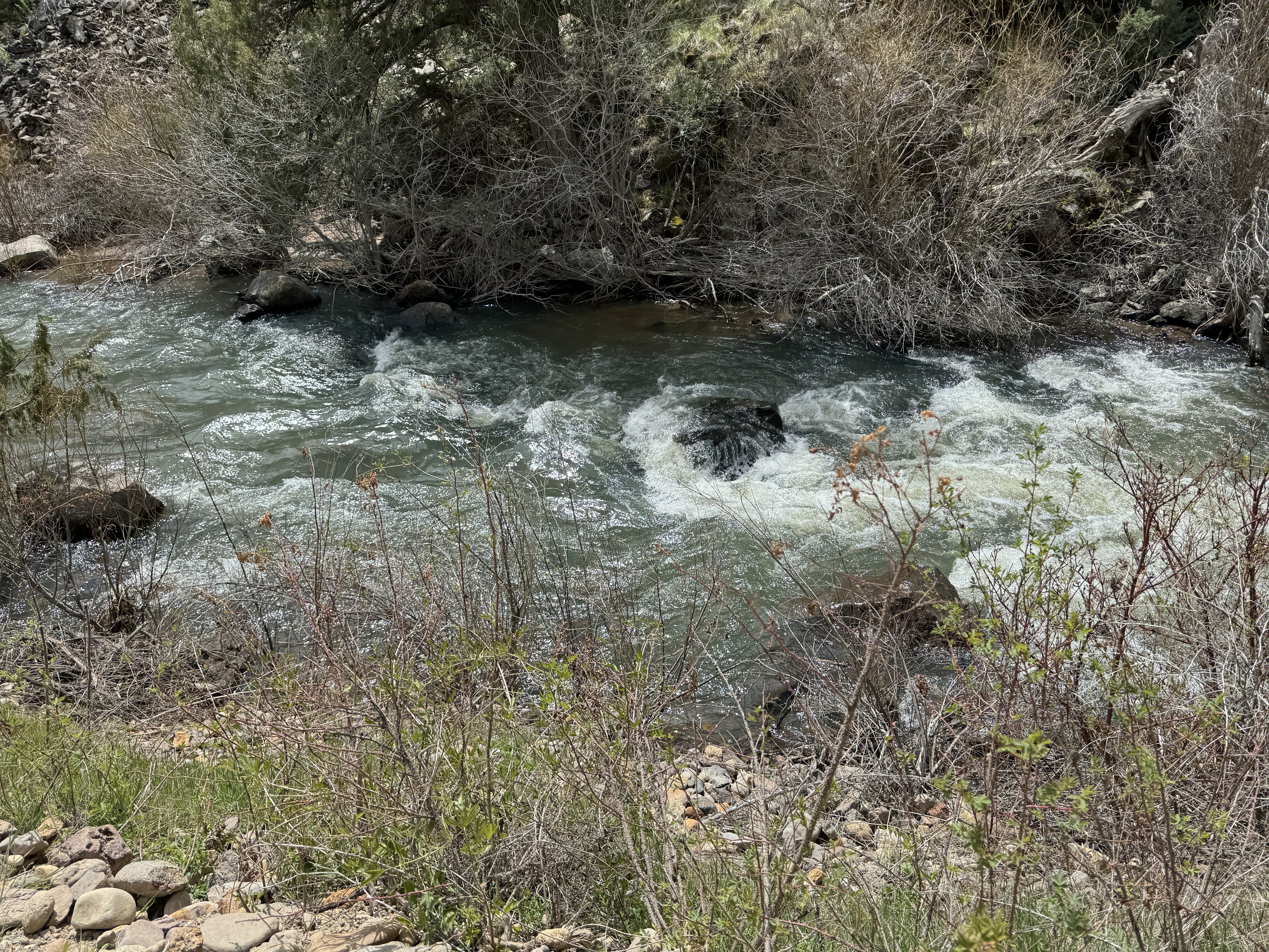
The next several hours were a pleasant walk through the valley alongside the Jarbidge River. At the "Forks" where two branches of the river merge, there is a raft launching point. There are also several BLM campgrounds along the road leading here. It seems that rafting is very popular on this river, and you can see why - it's wild and scenic, and gets more so the farther downstream you go.
 |
| The East Fork is fairly small and narrow. |
 |
| The raft launching point is at the confluence of the East Fork with the main river. |
 |
| A warning sign for prospective rafters. |
 |
| A map of the river canyon system ahead. The Jarbidge River feeds into the Bruneau River several miles downstream to the north. |
 |
| Designated wilderness begins at the edge of the raft launch site. |
 |
| The trail follows along the south side of the now considerably-wider river. |
 |
| Much of the trail along the river is a faint track resembling a game trail. |
 |
| The trail crosses several rockslides, but there is usually a flattened-area in the scree that tells you you're still on the right track. |
 |
| As I got to the area where I knew I'd have to climb up out of the canyon the next day, I came to this abandoned bridge abutment with a beautiful flat, grassy surface. |
 |
| The abutment made an almost-perfect campsite. The rocky ground made it challenging to get the tent stakes into the ground in optimal locations, but that was a minor inconvenience. |
The first thing I did when I stopped for the night was to charge my iPhone up to 100%, so that the battery pack would have time to charge in the sun while it was still available. I'd been impressed by the fact that the "charging" light on the battery would come on in even the most attenuated daylight. That didn't give me any indication of how efficiently it was charging, however, so I still wanted to maximize my use of sunlight while I had it. The phone had ended the day at 55%, so a full day's hike with OnX tracking activated had used 30% of the charge rather than the 20% I'd predicted based on testing at home.
I still had plenty of water left at this point, having only just started to use one of my two 2-liter Platypus containers. My expectation for the hike was that I would arrive at each water cache with about a half-day's supply in my pack, camp someplace nearby, and leave the next day with a full load of water (9 liters, 9.5 if I hydrated the RecPak before setting out). It may seem silly to have carried water up to this point while walking along the river, but I had determined not to rely on any natural sources, and wanted to ensure that my projections were correct before venturing out into the desert where I would have no choice but to rely on my periodic 2-gallon caches of water.
I had a very pleasant evening sitting outside in my Thermarest chair, preparing dinner, watching the light fade, and examining the map and the terrain to plan the next day's walk up out of the canyon. I was feeling very tired at this point, which was understandable given that it was the first day of all-day hiking. Every little task seemed to take me a long time to accomplish, but I didn't really mind because I was very happy to be there, and looking forward to eight or nine more days in the outdoors.
 |
| I had the idea to use my little backpacking tripod with my trekking pole as a "selfie stick". It worked ok, but I need to put something on it to keep it from spinning around the shaft. Not too bad for a first attempt! |
I called it a night and went to bed at 2115, again crawling under the tarp rather than taking it down to sleep under the stars. This is unusual for me, but I was so tired that all I wanted to do was sleep! I suppose this should have told me something, but I didn't think much of it at the time. Slowing down is part of growing older, so I just kept moving along getting everything done, and had a very sound night's sleep.
Thursday 2 May
The next morning I awoke early and struck camp fairly quickly. I had spent some time studying the satellite photo to find the best way up out of the canyon, and was pretty certain I could follow it. There was a two-track Jeep trail leading to the canyon edge from right near where I had cached my water. The presence of a bridge abutment on the river meant that it was reasonable to think that at some time there had been a road down into the canyon. The Johnson's book had mentioned a "long-abandoned two-track", and I could see some sort of a faint partial track across the canyon wall above. So I started my climb, looking frequently at the OnX map to ensure that I was at least very close to the track. It turned out that a lot of it was much more visible in the satellite photo than it was up close on the ground, but I was able to pick my way along without much trouble.
 |
| The OnX Backcountry map, with satellite view selected. The tent shows my campsite, the water droplet at the top is my water cache, and the waypoint marked "X" is the end of the two-track where I expected to come out of the canyon. The red dot was my position when I took the screen shot. A close examination of the terrain in between will reveal the faint trace of what used to be a road or trail down into the canyon. |
 |
| The same map, with topographic contour lines visible to show elevation. |
 |
| The prospective route up as seen from my camp. The curved saddle at top left was my objective. A faint line of the trail or road can be seen cutting across part of the canyon wall. |
 |
| A lot of the "trail" looked like this on the ground. I was very reliant on the satellite photo to ensure that I was on the right track. Of course I could have just picked my own way up, but in some places there actually was a trail, and even through the two-track was lost to time due to rockslides, etc, the original route was still likely to be the best way up to the top. |
 |
| At one point the trail was especially hard to follow, and I noticed that somebody had placed a white rock on top of a boulder as a marker. I added another white rock on top of it for emphasis. Do two rocks make a cairn? |
 |
| The view southeast from my rest stop at the saddle. You can see the bridge abutment campsite just to the right of the large tree that's a little below the center of the photo. |
 |
| My pack is resting against the large boulder that had been visible from the river on the far right end of the saddle. |
Although I had stopped for a couple of "breathers" on the way up, I had mostly just climbed slowly and steadily, and took my first rest stop at 1030, leaning my pack against the boulder I had seen from the river. My GPS showed a 546 ft. elevation gain in 0.41 miles. Quite a climb, but it had felt fairly easy, as I'd taken it slowly. A couple of USAF A-10 Thunderbolt aircraft had flown over the canyon on bombing runs during my climb, but I'd been unable to get my camera out in time to capture them. Of course none ever appeared while I was resting! It turned out that this saddle was not quite the top yet, so I saddled up (pun intended) and climbed the last few feet out of the canyon and up onto the plateau. I stopped at the edge to take a photo back the way I'd come, and turned 180º to take a photo from the edge of the canyon into the desert that would be my home for the next several days.
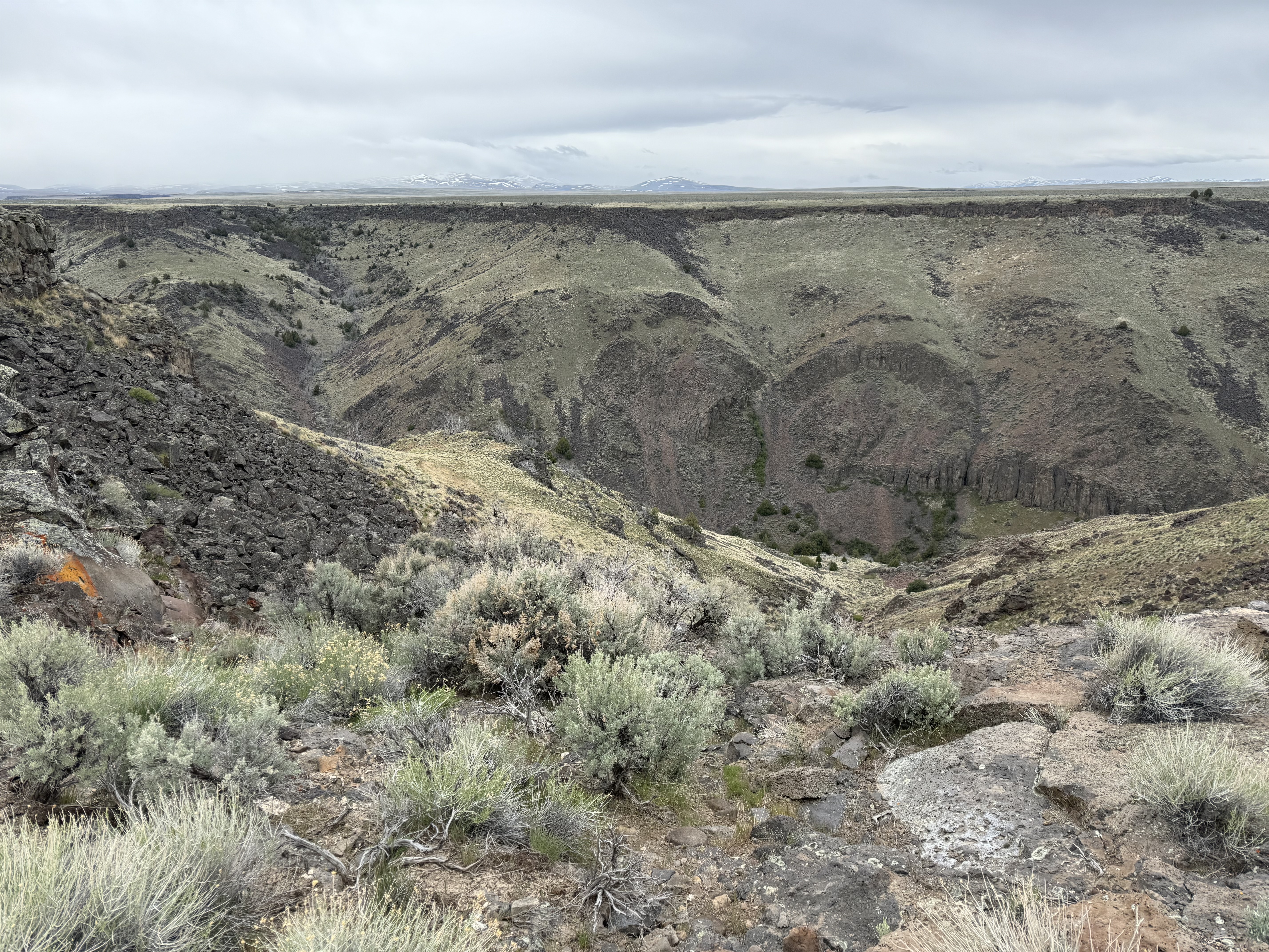 |
| The view to the south from the canyon rim. |
 |
| The view north into the Bruneau desert. |
I walked over to the fence near where I had placed my water cache, and was a bit dismayed to see that there was no sign of my little orange utility flags, nor was there any orange tape fluttering from the fencepost where I had tied it. It was all just *gone*! I knew the wind here was strong, but I hadn't expected my markers to just disappear. But so many of the sturdy white fiberglass ICT markers had been flattened and broken off by the wind that perhaps I should have expected it. Fortunately, I had several layers of redundancy in the way in which I'd marked the caches. "X" paces from the "Yth" fence post on a bearing of "Z" degrees took me straight to the spot, and I recovered my two gallons of water in perfect condition. I was glad to have buried them - As it turns out I should have been more concerned with whether they would freeze than whether they would stay cold!
I spent some time transferring the water into my various canteens and containers as well as crushing the bottles for transport and disposal. I also rehydrated a RecPak and drank my lunch while leaning against the wilderness sign at the site.
 |
| Through this gate, and the desert hike begins in earnest. |
While I was eating lunch and transferring water, two BLM employees drove by in a pickup. They asked how I was doing, and I told them I was fine, thanks. I remarked on the strength of the wind to have blown away my markers, and they said "Yes, maybe - but the elk also eat them." "They eat the plastic ribbon?", I asked incredulously. And they said "yes". So who knows what happened. But I had no concerns as I remembered each cache location very well, and had multiple ways to find each one.
I started off at 1245. This was a little later than I had hoped, but I was moving a little slowly. I was very surprised by how cold it was. It had warmed up and the thermometer said 50º F, but the wind was really ferocious and I felt the chill. Having shed clothing for the climb, I was back to t-shirt, long underwear top, hiking shirt, and rain/wind jacket with watch cap, wristovers, and gloves. When I am walking, I am a constant adjuster. I want to retain maximum warmth without breaking a sweat, so I remove things and open and close zippers as needed. In this case the constant wind sucked away warmth pretty quickly, so when I did open zippers or cuffs, it wasn't long before I'd close them again. I established a pretty good, steady rhythm, and was feeling good about making the 10.2 miles to the next cache by nightfall.
An almost constant feature of the desert from this point onward was the presence of cattle. I had run into them on my water caching trip, and began to run into them again now. They were mostly off in the distance grazing, but when they saw me they'd stop, look up, and watch me. Occasionally they'd begin to congregate and come over for a closer look. They'd stand there and watch while I walked by, and then suddenly run around ahead of me or behind me to take up another position from which to stare. When 20 or 30 of them would run off, the muted pounding of their hooves made it easy to imagine how loud and intimidating a stampede of a large herd would be. It also made it easier to imagine the life of a cowboy wrangling the herds. Cattle are dumb, dirty, smelly, nasty animals - their backsides were covered with excrement, their noses ran, and they slobbered as they stood there watching me. Occasionally I'd hear and see them belching/coughing up the contents of their stomachs to ruminate ("chew their cud"). It made the cowboy life seem considerably less romantic than the image you get from movies and TV shows, lol.
On one occasion early that afternoon, however, I ran into a band of horses. Nervous at first (I imagine since they are not used to seeing people on foot), they were similarly curious. It happened to be time for a rest, so I stopped there. I propped up my backpack on my trekking poles to make myself a backrest, and settled in for a few minutes to breathe, drink water, and nibble a little Kendal Mintcake for energy. It wasn't long before the horses came up behind me to investigate. I was pretty sure they were not wild, although I could not see any brands or tags. Just the same, I spoke to them, but did not touch them even though it was tempting - they seemed to be looking for a handout.
 |
| I passed this small band of horses off in the distance. |
 |
| I zoomed in with the camera, never imagining they'd come closer to me. |
 |
| After I stopped to rest, they came over to satisfy their curiosity. Note the raindrops spattered on my backpack. |
 |
| I thought this was cute until I realized that a thousand-plus pounds of horse was standing right by my $200 carbon fiber trekking poles, and waved them off. |
I started off from this rest stop at 1400, now wearing rain pants and gaiters as the rain had started in earnest. Unlike the mountains where you can easily be surprised by changes in the weather, the wide-open vistas of the desert allow you to see rain a long way off. There had been localized showers visible around me all day off in the distance, but now I was in one. My notes from the rest of the afternoon reflect intermittent rain, as well as stopping at one point to care for my feet with rubbing alcohol, foot powder, and dry socks (they were damp from perspiration, not from the rain - that's the downside of having to "button up" with gaiters and rain pants to keep out the rain and mud). I also noted that I wasn't feeling quite right - I felt "too full" from my 16 oz. RecPak lunch, and thought perhaps I should drink only half of it at a time to space it out.
I made steady progress, despite the rain turning the surface into an instant quagmire of sticky mud that accumulated on my boots and made traction difficult. I took to watching the ground and picking my path as carefully as I could, trying to step on clumps of grass and other growth rather than squarely in the mud (which included lots of cow pies). This turned the afternoon walk into more of a slog, punctuated by hourly rest stops during which I'd make notes in my "Rite-in-the-Rain" notebook with the special mechanical pencil that goes with it. This validated the fact that you actually can write in the rain with it - first time I'd actually tried it. By 1805, I'd gone 6.55 miles, and decided to stop using the tracking feature of OnX as it was taking too much battery power. I figured if I really wanted a track on the map, I could import the Garmin track once I returned home. This also meant that I'd no longer have exact measurements of my progress, but since I could see the waypoints on the map and make fairly good estimates, this wasn't really an issue. All part of learning how best to use the OnX GPS maps and the Garmin Messenger in concert.
At 1930, I finally decided to stop for the night. I was still a little less than 3 miles short of water cache #2, but I was feeling pretty tired, progress was slow, and the weather was getting worse. I still had plenty of water to get through the night and the next morning, and to walk to the cache. This had been part of my plan all along - each cache contained more water than I would expect to use in a day, giving me some flexibility as to when and where to stop for the night depending on conditions. In this case I resolved to wait for morning to walk the rest of the way. There were a few scattered snowflakes as I began to set up my tarp, and by the time it was completely up and I was ready to move in, I'd already had to shake the snow off of it several times, as it was a full-blown snowstorm.
 |
| The last photo I took before crawling inside for the night. |
Getting under the tarp and into bed without getting everything wet and muddy was a bit of a process, but I've done it enough times in my life that I'm pretty good at it. And with the new tarp, I was spared the necessity of making sure everything was covered and secure from the weather. With my old tarp, the snow and rain would have been blowing in from the edges and it would have been much harder to stay dry. With this one it almost doesn't matter what's happening outside, except that I couldn't have it open for a view (not that there was much to see on this night!) I had my Mountain House freeze-dried dinner and a mug of hot Jasmine-flavored green tea, and went to bed.
I was dry, warm, and snug, but it was a restless and uncomfortable night nonetheless. I had started off the trip with a mild postnasal drip that was causing me to cough occasionally to clear my lungs. I'd taken Sudafed to try to dry it up a bit but during the night my cough worsened. Additionally, my sleep apnea was bothering me. I use a CPAP machine at home, but it's impractical for trips like this. Usually this doesn't bother me at all and I sleep soundly, but during this night I kept startling myself awake with an "event" (in CPAP software terms). Of the most concern to me was that I kept having to get up to pee every 30 to 45 minutes, but would have little result despite the feeling of urgency.
I always closely monitor the color of my urine as a measure of hydration - light is good, dark is bad (drink more water). I'd been drinking water like there was no tomorrow, almost more than I could comfortably swallow, and yet my urine color had remained persistently dark for much of Thursday afternoon. I couldn't really tell what it looked like overnight when I went outside, but I made sure to always take a few swallows from the Camelbak after coming inside, just to make sure I didn't dehydrate. My last entry in the notebook for that day is "Long night. See messages." I had texted my wife and said I thought I might have a UTI and was starting antibiotics (as I have been subject to those in the past, I have a prescription to carry in my first aid kit).
Friday, 3 May
I awoke at 0545 and went through the process of getting up and out for the day. I was surprised and dismayed when I had a little mini-vomit while eating breakfast. It was more of a burp with a full esophagus, but very unusual for me. As with the RecPak the day before, I thought it was just from eating too fast and drinking so much water to stay hydrated.
It had become more and more of a chore to take notes, and they became much more cursory and less detailed. My only note from that morning is: "Everything takes me so long! Started 0930." At 1105 I wrote "Almost to cache 2. I am fantasizing about hitching a ride, lol. Should have put the caches 5 miles apart."
I reached cache #2 at 1210. Again there was no trace of any of my markers, but I found it with no trouble. I went through the process of transferring the water, ending up with completely full containers and just enough left in the cache bottle to take a few swallows to empty it. By this time it was a beautiful sunny afternoon, and I basked in the sun for a few minutes leaning against my backpack.
The last entry in my notebook reads: "Repacked everything. I am so slow! Not feeling well. My stomach doesn't feel right - not hungry for lunch, feels like I could vomit or get the runs. 🙁 Still have a persistent cough, too. At least the weather is nice today. It is supposed to get cold and wet very soon." I texted my wife that I was "...sitting in the sun mustering the will to get going."
I sat there for about 45 minutes or so, considering my condition and the prospect of several days of walking in rain or snow, forced to move each day by the need to reach water, and perhaps suffering the effects of (or at least trying to fight off) a stomach bug, possible pneumonia, or whatever the heck was wrong with me. After a fair amount of soul-searching and lecturing myself about being responsible, I got out the Garmin Messenger and pressed the "SOS" key. This brought up a slide bar, which I slid to the right to send the SOS. A 20 second countdown appeared on the screen. As I watched it count down to zero, I thought "Well, that's it. Now everything about this trip changes". I hated to have to do it, but it was also a relief.
I texted back and forth with the Garmin response staff, giving them details about my condition and what I had done to mitigate my symptoms. Then I texted my family to let them know what I'd done, and settled down to wait.
It didn't take long for Garmin to let me know that a helicopter was on the way, ETA 50 minutes from that time (!) I was surprised - I had expected someone to drive out. A helicopter seemed so dramatic! But upon reflection, of course it made the most sense. For one thing it was the fastest response. It also would be the least time-intensive, as having someone drive out there would take them the better part of an entire day. I just hadn't been thinking too clearly about what I was setting in motion. Once I knew a helicopter was coming, I set out my space blanket with the silver side up, and weighted it down with rocks in the corners.
I heard the helicopter arriving, right on schedule, and packed things up to be ready to go. The county had sent three people - the pilot and two EMS personnel. I was surprised at how little information had been passed to them - all they knew was "64-year-old male, diarrhea and vomiting" (none of which was accurate!) They knew nothing about my actual symptoms nor the medications I had already taken, all of which I had carefully reported. Still, the response was impressive. We talked for a few minutes, and I told them I really didn't think I needed medical care per se, just an extraction. My intent was to get back, check into a hotel, and then go to an Urgent Care facility to see what was wrong with me and get some medicine for it.
They agreed to this, so at my request it turned from a MEDEVAC into a SAR mission. They had some bureaucracy to attend to, and then we loaded up and left. I requested some Dramamine, as I do not do well on small aircraft, and they gave me something similar that they said was better. The 15 minute flight back to Hammett seemed much longer than 15 minutes, and proved that whatever they had given me for airsickness was ineffective in my case. I felt pretty wrung out by the time they landed and dropped me off. The pilot had done an amazing job of getting me where I'd requested, landing just downhill from the winery on some BLM land. I called Jennifer, and she came down to pick me up and take me up the hill to my Jeep.
After a few minutes freshening up and a cold drink of water, I called and made a reservation at the Best Western in Mountain Home, 17 miles away. I planned to check in, take a shower, and then go to an Urgent Care facility (I didn't think it would be very considerate to show up for an examination in the clothes I'd been wearing for four days). The drive to the hotel revealed just how tired I was, but cold A/C, loud music and chewing gum kept me awake and on the road until I got there. I checked in, took a hot bath and shower, and prepared to drive to the medical facility.
Three hours later, a persistent ringing noise roused me from a deep, deep sleep. I groggily answered the hotel phone, and it was my wife, who had been worried and trying to find me. The last thing she'd heard was that I was being flown out, and I had not reported in since then. The ringer on my phone was turned off so her calls went unheard. Fortunately, we both have "Find my iPhone" turned on, and she was able to zoom in on the map and see that I was at the Best Western, get the phone number, and call my room.
After a brief conversation in which I apologized for having fallen asleep and not following up (I hadn't really realized how tired I was), I drove the two miles to the urgent care. By then it was closed, so I had to go to the Emergency Room. I let them know my symptoms, recent history, medication I'd taken, and what I suspected it was. They took my vitals and some blood for testing. Before long, the doctor came back in and told me his diagnosis:
"What's that?" I asked him. "I've never heard of it before." "Most people haven't", he said. He explained what it was, and said that he was admitting me to the hospital for treatment and observation. This surprised me greatly, but he insisted that it was necessary, so we went through the process of inpatient admission. I spent the rest of Friday night in a hospital room on IV fluids to flush my system.
Saturday 4 May
Saturday morning, they ran another blood test and I had a consultation with the attending physician. By then I had read up on Rhabdomyelosis, and realized that I had been *way* more sick than I had suspected. We discussed my condition, and he told me that he wanted me to stay another night to make sure I was OK. My numbers were trending in the right direction, but he wanted two days of downward trend before releasing me. By this point, I was absolutely *not* inclined to argue, so I spent all day Saturday and Saturday night in a hospital bed hooked to an IV while my system slowly flushed out all the proteins and enzymes that were making me ill.
Because I had not expected to be admitted, I'd come to the hospital with nothing but what I was wearing. Everything else was in the hotel room (which was now just an expensive storage facility and parking spot, lol). I had texted my family about what was happening, looked up a bunch of articles on Rhabdo, and caught up a little on email and Facebook. I had to laugh, as one one of my friends had posted something on Saturday morning that could have been intended especially for me:

 |
| SOS: Slow, Old, and Sensible |
I started to wonder how long my iPhone battery would last, and asked for a charging cable. As it turns out, they had none available. With the iPhone 15, Apple finally (belatedly, in my view) changed from their proprietary Lightning cable to a USB-C port like the iPad and the Mac. So now all my Apple devices use the same form-factor charging cable. But it's still not ubiquitous enough that you can expect to find charger cables available everywhere. Wanting to husband the power in my phone, I reluctantly turned on the hospital room TV.
Normally I would have no truck with mainstream TV, but that's all there was. Fortunately for me, it was May 4th, and TBS was running a "May the Fourth Be With You" Star Wars marathon all weekend long. I caught the last part of Episode IV and then watched "The Empire Strikes Back" and "Return of the Jedi" in their entirety. That occupied most of the day, along with all the requisite nurse visits and other hospital protocol. I finally turned it off and had a good night's sleep.
Sunday 5 May
Sunday morning I was feeling much better and was very antsy to get up and get going. Fortunately my numbers from that morning's blood test were good enough that the doctor agreed to release me, although he said full recovery would take several more days, at least. Before releasing me, the doctor went into a bit more detail on my blood work and what it meant. The degree of Rhabdomyolysis is measured by the level of Creatine Kinase (CK) in the bloodstream. A fairly high level, such as might be reached after a heavy workout, is 400-500 (I presume this is in ppm, but nobody ever mentioned the unit of measure). This level would take a couple of days to recover from, and is not damaging. At about 5,000, the danger of long-term kidney damage becomes significant.
When I was admitted, I was at 4,000, which was cause for concern. He said that he had seen people admitted at 2,000 who jumped to 10,000 within a few hours. So with me, they caught it in time before it rose into the range where I'd be expecting long-term damage, but I was almost certainly headed in that direction! Saturday morning I was at around 400, which would still require a couple of days' recovery but was clearly not serious enough to warrant continuing the hospital stay.
The doctor also asked me about my oxygen level, which was somewhat lower than he likes to see. I asked him if this could affect the Rhabdo or make me more subject to it, and he said "Oh, yes!" That's when the light bulb really went on for me. Oxygen is required for the metabolic processes in your muscles, and is also required in order to eliminate the waste products from Rhabdo, should it develop. There were several factors that had impacted my ability to maintain oxygen saturation on this trip:
1. I started the trip with congested lungs and a cough. Not severely congested, but enough to have some negative impact on my lung efficiency.
2. My sleep apnea reduces the oxygen in my blood, as well as disrupts my sleep and thus my rest and recovery ability. The doctor recommended a "dental device" for when I cannot have my machine.
3. Failure to acclimate to the altitude. We live at 2500 feet altitude in Coeur d'Alene. The ICT trailhead is at almost 6,000 ft. Even though 6,000 ft is not high enough to be concerned about altitude sickness, it is enough to make a difference in atmospheric oxygen concentration:
 |
| According to this chart, oxygen concentration at the ICT trailhead is about 2.5% lower than it is where I live in Coeur d'Alene. |
4. Finally, I had started off the trip exhausted to begin with. I normally allow myself at least a day or two to recover from an Appleseed event. In this case I ran the event Saturday and Sunday, did a whirlwind follow-up on Monday, then drove all day Tuesday and started the hike on Wednesday.
None of these factors seemed too significant by themselves, but in combination they apparently reduced my body’s efficiency enough to allow the slow, insidious buildup in my bloodstream of the proteins and enzymes that overwhelmed my ability to process them and made me sick.
I had already promised my wife and family that I would not attempt to drive the entire way home (about an eight hour drive) in one shot. I told them I'd follow my own advice:

In any case, I didn't really want to go straight home. My backcountry adventure had been cut short, and I wanted at least one more night outdoors. As it turned out, there was a perfect place to turn off for an overnight interlude on the way home.
Last summer I had driven up over Orogrande Summit and deep into the old mining-claim incursion in the Gospel Hump Wilderness. At the time, I had also seen that over on the western edge of the wilderness, there was a trailhead accessible by USFS road from US-95 north of Riggins. As the ICT passes right by there (at least the original route that's on the map), I decided to drive up there and have a look.
It was about a four-hour drive from Mountain Home to Slate Creek Road just north of the town of Lucille. I turned off there and drove east into the mountains above the Salmon River. The first few miles were private property, with some beautifully-situated homesteads in enviable proximity to the wilderness. Then I passed onto USFS land, and it was just the road (now USFS Road 354), the woods, and the creek. Slate Creek is a beautiful stream that cascades through a rocky mountain gorge, with plenty of places to pull over and park for fishing or whatever. There is even at least one campground up there. I generally eschew established campgrounds, and I wanted to see the trailhead, so I went all the way up to the end of the road (I think it was about 18 miles). Later examination of the map shows that had I turned north, I could have kept going all the way to Moore's Station. But at the time it was getting late and I wanted to find a place to camp before dark, so I turned around.
 |
| The trailhead at the top of USFS Road 354. I could have continued around on USFS Road 444 (Moore's Station Rd), but ran out of time that day. |
I ended up in a large meadow between the road and the creek. By now I had worked out a procedure for quickly pitching the tarp in the rain while keeping the inside dry. I wasn't really equipped for Jeep camping, but I had stopped and bought a can of beef stew and box of Wheat Thins. I sat in my folding chair and prepared dinner on the tailgate table. I ended up cooking and eating in the rain, wearing my rainsuit, but it was pleasant and relaxing. I then I crawled under the tarp, buttoned up, and spent a long, warm, cozy night sleeping to the constant drumming sound of the steady rain.
 |
| Cooking and eating in the dark on the fuel tab stove. The folding aluminum windscreen is the only piece of my original 1970s backpacking outfit that is still in active service. |
 |
| Between the roar of the nearby creek and the drumming of the rain on the tarp, I had plenty of white noise to help me sleep. |
Monday 6 May
When I awoke on Monday morning, I decided not to bother with breakfast, but to get on the road ASAP and eat on the way. I was up, packed, and on the road by 0630, less than an hour after waking up. I drove back up over White Bird Hill Once again listening to Tom Petty), and then descended back onto the Camas Prairie to have breakfast in Grangeville. This time I did stop at Jimmy John's on the ride home and got my "Gargantuan" (is it my imagination, or has that sandwich shrunk from its former size?). The drive home was uneventful, and I was happy to arrive early enough in the day to enjoy a long, slow afternoon of gradual unloading and easing back into life at home. This was the official end of the trip. The rest of the week has been a gradually accelerating recovery as I regain my energy level and ability to concentrate.
Lessons Learned:
1. Don't leave on a strenuous backcountry trip right after an Appleseed shoot. (See "Backpacking in the Lemhi Range", 2021.) I'd supposedly learned this lesson already, but I guess it needed to be reinforced.
2. Allow time to acclimatize. Even if not high enough for altitude sickness, a significant change in elevation has an effect on oxygen levels.
3. I need a dental device to mitigate my sleep apnea when I cannot have my CPAP machine with me.
4. Listen to my body and don't minimize my symptoms. Yes, I did make the decision to call for extraction. But I didn't really think I was that sick - I was doing it as a preventive measure because I knew what was coming up in the next few days. If I'd have been in the mountains someplace with ready access to water (vs. having to move 10(+) miles every day to a cache), I might have just hunkered down to wait it out. And even after calling for evacuation, I didn't have EMS treat me on the spot. It would have been better to put myself completely in their hands from the outset. My body and my judgment were more severely impaired than I had realized.
5. Have a scanned copy of my Advance Directive in my phone. I have a copy at home, and my wife is listed as an emergency contact in my phone, but that is not good enough. I was not clear-headed enough to answer questions about this when it came to being admitted to the hospital (and of course it's possible I might be unconscious). It would be *much* better to have it available with me, rather than rely on medical authorities to contact her.
6. The Owhyhee Tarp is well-designed and admirably suited to its intended role. It will be my go-to shelter for 3-season use in moderate terrain. In steep mountains, I will almost certainly revert to using my Haven Hammock tent.
7. The switch to a solid fuel stove was a sound, viable choice. The titanium stove from Expedition Research performed well, especially when paired with the folding windscreen. I took five fuel tabs per day, but four would have been more than adequate.
8. My water caching technique worked well. If I ever go back to re-try the desert section, I expect caches three through eight will still be there and be in good shape.
9. The OnX Backcountry GPS map is an excellent tool, but the tracking function really eats up the battery. It would nice to be able to have trip stats even if tracking were turned off. Need to investigate.
10. *Always* check the charge on every device right before leaving, even if it was left turned off.
11. The 4Patriots solar battery pack appears to have performed well, although it did not really get a full test. I will continue to use it.
12. My $90 Outdoor Research gloves are *not* waterproof! After an hour or so in the rain, they became saturated. Additionally, they were extremely hard to put on over wet fingers. They were better than exposed fingers, so I wore them, but they were a pain and will be relegated to town-only wear. I need a good pair of lightweight Gore-Tex gloves.
13. My pack is still too heavy by most people's standards, even though it is comfortable for me. Continue to chip away at the weight of each item (e.g. Nalgene bottles) by looking for lighter alternatives.
Mood: Happy
Music: Sons of the Pioneers - "Cool Water"
posted by Brad @ 4:48:00 PM
3 comments
![]()
![]()

